You are here: Home > Network List > IC - New China Digital Seismograph Network Stations List
> Station ENH Enshi, Hubei Province, China > Earthquake Result Viewer
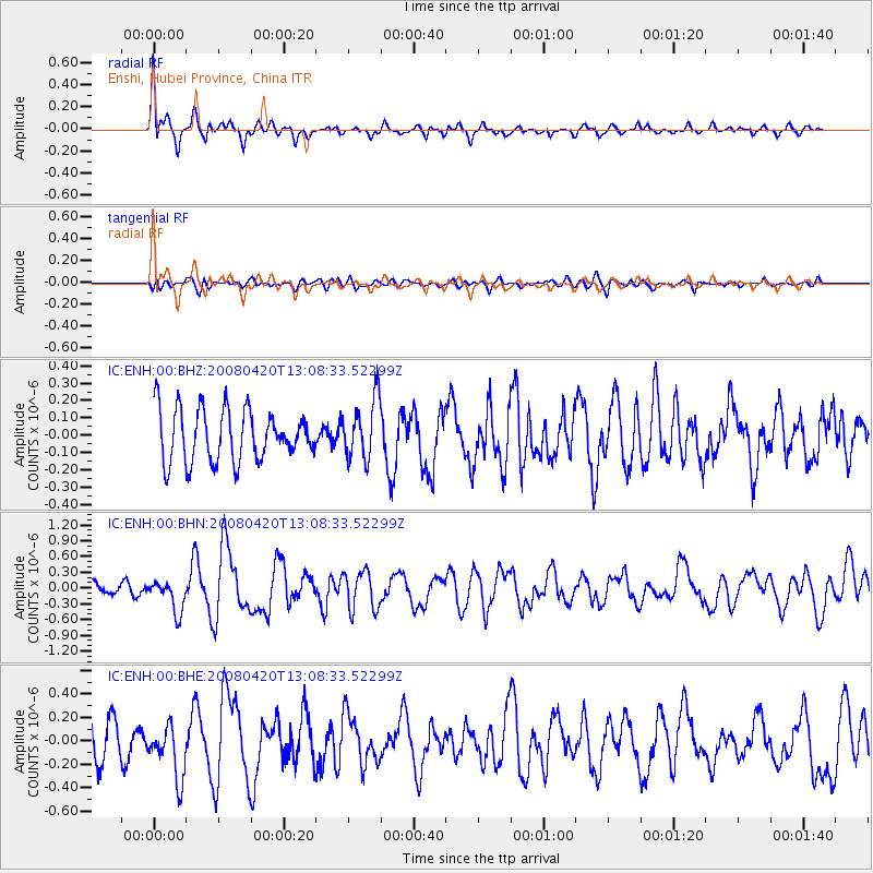
ENH Enshi, Hubei Province, China - Earthquake Result Viewer
*The percent match for this event was below the threshold and hence no stack was calculated.
| Earthquake location: |
Banda Sea |
| Earthquake latitude/longitude: |
-7.8/125.7 |
| Earthquake time(UTC): |
2008/04/20 (111) 13:01:20 GMT |
| Earthquake Depth: |
3.6 km |
| Earthquake Magnitude: |
5.6 MB, 5.1 MS, 5.6 MW, 5.6 MW |
| Earthquake Catalog/Contributor: |
WHDF/NEIC |
|
| Network: |
IC New China Digital Seismograph Network |
| Station: |
ENH Enshi, Hubei Province, China |
| Lat/Lon: |
30.27 N/109.49 E |
| Elevation: |
487 m |
|
| Distance: |
41.0 deg |
| Az: |
338.404 deg |
| Baz: |
155.07 deg |
| Ray Param: |
$rayparam |
*The percent match for this event was below the threshold and hence was not used in the summary stack. |
|
| Radial Match: |
75.79511 % |
| Radial Bump: |
400 |
| Transverse Match: |
42.99671 % |
| Transverse Bump: |
400 |
| SOD ConfigId: |
2504 |
| Insert Time: |
2010-03-04 21:59:26.015 +0000 |
| GWidth: |
2.5 |
| Max Bumps: |
400 |
| Tol: |
0.001 |
|
Signal To Noise
| Channel | StoN | STA | LTA |
| IC:ENH:00:BHN:20080420T13:08:33.52299Z | 2.0505466 | 3.0238687E-7 | 1.4746647E-7 |
| IC:ENH:00:BHE:20080420T13:08:33.52299Z | 1.8707012 | 2.2961105E-7 | 1.2274063E-7 |
| IC:ENH:00:BHZ:20080420T13:08:33.52299Z | 1.167509 | 1.7395041E-7 | 1.4899278E-7 |
| Arrivals |
| Ps | |
| PpPs | |
| PsPs/PpSs | |


