You are here: Home > Network List > AV - Alaska Volcano Observatory Stations List
> Station SPCR Ckakachatna River, Mount Spurr, Alaska > Earthquake Result Viewer
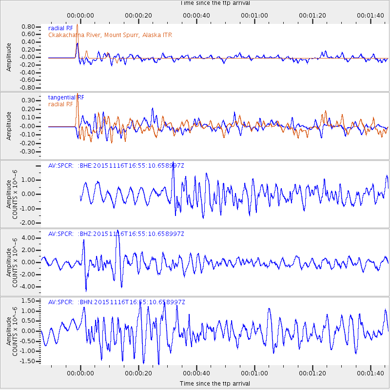
SPCR Ckakachatna River, Mount Spurr, Alaska - Earthquake Result Viewer
*The percent match for this event was below the threshold and hence no stack was calculated.
| Earthquake location: |
Kuril Islands |
| Earthquake latitude/longitude: |
48.3/154.3 |
| Earthquake time(UTC): |
2015/11/16 (320) 16:49:15 GMT |
| Earthquake Depth: |
42 km |
| Earthquake Magnitude: |
5.8 MWB |
| Earthquake Catalog/Contributor: |
NEIC PDE/NEIC COMCAT |
|
| Network: |
AV Alaska Volcano Observatory |
| Station: |
SPCR Ckakachatna River, Mount Spurr, Alaska |
| Lat/Lon: |
61.20 N/152.21 W |
| Elevation: |
984 m |
|
| Distance: |
32.5 deg |
| Az: |
46.464 deg |
| Baz: |
271.402 deg |
| Ray Param: |
$rayparam |
*The percent match for this event was below the threshold and hence was not used in the summary stack. |
|
| Radial Match: |
71.88584 % |
| Radial Bump: |
400 |
| Transverse Match: |
74.082405 % |
| Transverse Bump: |
400 |
| SOD ConfigId: |
7422571 |
| Insert Time: |
2019-04-21 09:26:41.433 +0000 |
| GWidth: |
2.5 |
| Max Bumps: |
400 |
| Tol: |
0.001 |
|
Signal To Noise
| Channel | StoN | STA | LTA |
| AV:SPCR: :BHZ:20151116T16:55:10.658997Z | 3.7649434 | 1.763413E-6 | 4.6837707E-7 |
| AV:SPCR: :BHN:20151116T16:55:10.658997Z | 2.2716026 | 5.866051E-7 | 2.5823402E-7 |
| AV:SPCR: :BHE:20151116T16:55:10.658997Z | 2.026454 | 9.192276E-7 | 4.5361386E-7 |
| Arrivals |
| Ps | |
| PpPs | |
| PsPs/PpSs | |


