You are here: Home > Network List > CI - Caltech Regional Seismic Network Stations List
> Station GLA Glamis, Glamis, CA, USA > Earthquake Result Viewer
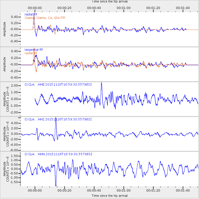
GLA Glamis, Glamis, CA, USA - Earthquake Result Viewer
*The percent match for this event was below the threshold and hence no stack was calculated.
| Earthquake location: |
Kuril Islands |
| Earthquake latitude/longitude: |
48.3/154.3 |
| Earthquake time(UTC): |
2015/11/16 (320) 16:49:15 GMT |
| Earthquake Depth: |
42 km |
| Earthquake Magnitude: |
5.8 MWB |
| Earthquake Catalog/Contributor: |
NEIC PDE/NEIC COMCAT |
|
| Network: |
CI Caltech Regional Seismic Network |
| Station: |
GLA Glamis, Glamis, CA, USA |
| Lat/Lon: |
33.05 N/114.83 W |
| Elevation: |
610 m |
|
| Distance: |
66.7 deg |
| Az: |
66.084 deg |
| Baz: |
313.378 deg |
| Ray Param: |
$rayparam |
*The percent match for this event was below the threshold and hence was not used in the summary stack. |
|
| Radial Match: |
84.043015 % |
| Radial Bump: |
400 |
| Transverse Match: |
69.45156 % |
| Transverse Bump: |
400 |
| SOD ConfigId: |
7422571 |
| Insert Time: |
2019-04-21 09:27:34.554 +0000 |
| GWidth: |
2.5 |
| Max Bumps: |
400 |
| Tol: |
0.001 |
|
Signal To Noise
| Channel | StoN | STA | LTA |
| CI:GLA: :HHZ:20151116T16:59:30.557983Z | 2.1576443 | 9.35859E-7 | 4.3374112E-7 |
| CI:GLA: :HHN:20151116T16:59:30.557983Z | 1.0101383 | 3.5205994E-7 | 3.4852647E-7 |
| CI:GLA: :HHE:20151116T16:59:30.557983Z | 1.194706 | 4.4302482E-7 | 3.708233E-7 |
| Arrivals |
| Ps | |
| PpPs | |
| PsPs/PpSs | |


