You are here: Home > Network List > IC - New China Digital Seismograph Network Stations List
> Station ENH Enshi, Hubei Province, China > Earthquake Result Viewer
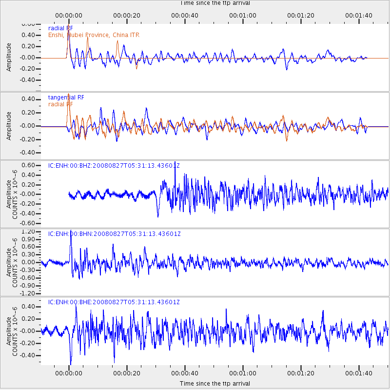
ENH Enshi, Hubei Province, China - Earthquake Result Viewer
*The percent match for this event was below the threshold and hence no stack was calculated.
| Earthquake location: |
Kuril Islands |
| Earthquake latitude/longitude: |
46.7/152.5 |
| Earthquake time(UTC): |
2008/08/27 (240) 05:24:41 GMT |
| Earthquake Depth: |
65 km |
| Earthquake Magnitude: |
5.5 MB, 5.4 MW, 5.3 MW |
| Earthquake Catalog/Contributor: |
WHDF/NEIC |
|
| Network: |
IC New China Digital Seismograph Network |
| Station: |
ENH Enshi, Hubei Province, China |
| Lat/Lon: |
30.27 N/109.49 E |
| Elevation: |
487 m |
|
| Distance: |
36.9 deg |
| Az: |
259.048 deg |
| Baz: |
51.326 deg |
| Ray Param: |
$rayparam |
*The percent match for this event was below the threshold and hence was not used in the summary stack. |
|
| Radial Match: |
71.10584 % |
| Radial Bump: |
400 |
| Transverse Match: |
68.12858 % |
| Transverse Bump: |
400 |
| SOD ConfigId: |
2504 |
| Insert Time: |
2010-03-04 21:59:46.123 +0000 |
| GWidth: |
2.5 |
| Max Bumps: |
400 |
| Tol: |
0.001 |
|
Signal To Noise
| Channel | StoN | STA | LTA |
| IC:ENH:00:BHN:20080827T05:31:13.43601Z | 7.057314 | 4.1658075E-7 | 5.902823E-8 |
| IC:ENH:00:BHE:20080827T05:31:13.43601Z | 2.6823134 | 2.0221107E-7 | 7.5386815E-8 |
| IC:ENH:00:BHZ:20080827T05:31:13.43601Z | 3.7817125 | 1.8925306E-7 | 5.0044275E-8 |
| Arrivals |
| Ps | |
| PpPs | |
| PsPs/PpSs | |


