You are here: Home > Network List > LD - Lamont-Doherty Cooperative Seismographic Network Stations List
> Station MVL Millersville University, PA > Earthquake Result Viewer
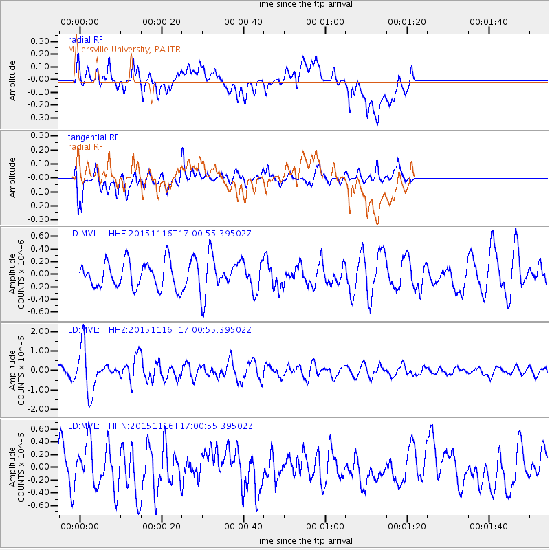
MVL Millersville University, PA - Earthquake Result Viewer
*The percent match for this event was below the threshold and hence no stack was calculated.
| Earthquake location: |
Kuril Islands |
| Earthquake latitude/longitude: |
48.3/154.3 |
| Earthquake time(UTC): |
2015/11/16 (320) 16:49:15 GMT |
| Earthquake Depth: |
42 km |
| Earthquake Magnitude: |
5.8 MWB |
| Earthquake Catalog/Contributor: |
NEIC PDE/NEIC COMCAT |
|
| Network: |
LD Lamont-Doherty Cooperative Seismographic Network |
| Station: |
MVL Millersville University, PA |
| Lat/Lon: |
40.00 N/76.35 W |
| Elevation: |
91 m |
|
| Distance: |
81.3 deg |
| Az: |
36.914 deg |
| Baz: |
328.526 deg |
| Ray Param: |
$rayparam |
*The percent match for this event was below the threshold and hence was not used in the summary stack. |
|
| Radial Match: |
68.71057 % |
| Radial Bump: |
400 |
| Transverse Match: |
74.034615 % |
| Transverse Bump: |
400 |
| SOD ConfigId: |
7422571 |
| Insert Time: |
2019-04-21 09:30:27.047 +0000 |
| GWidth: |
2.5 |
| Max Bumps: |
400 |
| Tol: |
0.001 |
|
Signal To Noise
| Channel | StoN | STA | LTA |
| LD:MVL: :HHZ:20151116T17:00:55.39502Z | 3.934341 | 1.2339761E-6 | 3.136424E-7 |
| LD:MVL: :HHN:20151116T17:00:55.39502Z | 2.2406774 | 3.3910075E-7 | 1.513385E-7 |
| LD:MVL: :HHE:20151116T17:00:55.39502Z | 1.6040655 | 3.352587E-7 | 2.090056E-7 |
| Arrivals |
| Ps | |
| PpPs | |
| PsPs/PpSs | |


