You are here: Home > Network List > IC - New China Digital Seismograph Network Stations List
> Station ENH Enshi, Hubei Province, China > Earthquake Result Viewer
ENH Enshi, Hubei Province, China - Earthquake Result Viewer
*The percent match for this event was below the threshold and hence no stack was calculated.
| Earthquake location: |
Banda Sea |
| Earthquake latitude/longitude: |
-4.7/129.8 |
| Earthquake time(UTC): |
2009/01/20 (020) 10:46:53 GMT |
| Earthquake Depth: |
144 km |
| Earthquake Magnitude: |
5.7 MB, 5.5 MW, 5.5 MW |
| Earthquake Catalog/Contributor: |
WHDF/NEIC |
|
| Network: |
IC New China Digital Seismograph Network |
| Station: |
ENH Enshi, Hubei Province, China |
| Lat/Lon: |
30.27 N/109.49 E |
| Elevation: |
487 m |
|
| Distance: |
39.8 deg |
| Az: |
332.013 deg |
| Baz: |
147.271 deg |
| Ray Param: |
$rayparam |
*The percent match for this event was below the threshold and hence was not used in the summary stack. |
|
| Radial Match: |
74.72406 % |
| Radial Bump: |
400 |
| Transverse Match: |
69.71686 % |
| Transverse Bump: |
400 |
| SOD ConfigId: |
2834 |
| Insert Time: |
2010-03-04 22:00:09.179 +0000 |
| GWidth: |
2.5 |
| Max Bumps: |
400 |
| Tol: |
0.001 |
|
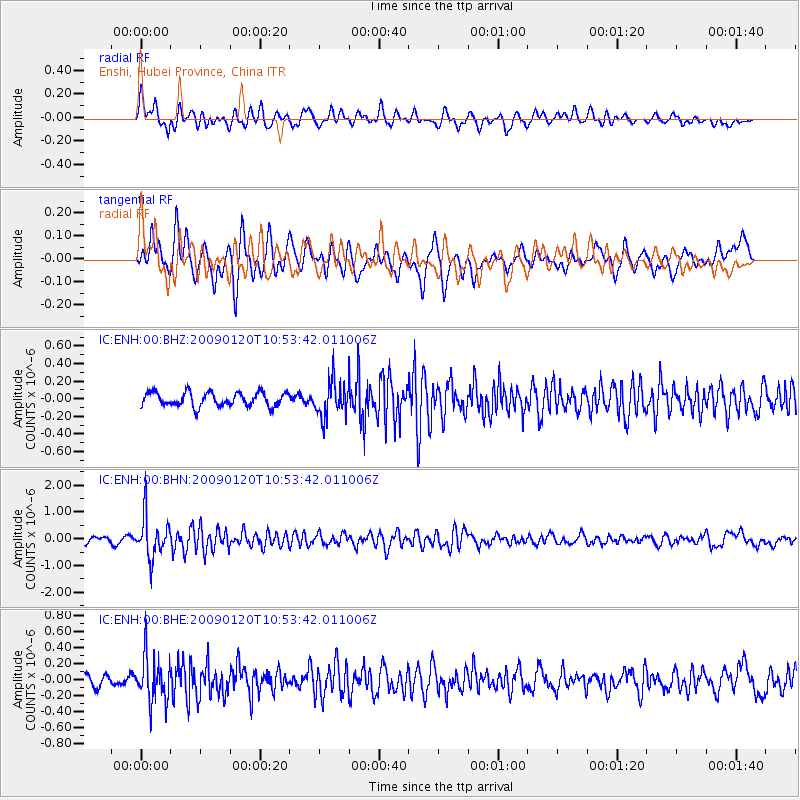
Signal To Noise
| Channel | StoN | STA | LTA |
| IC:ENH:00:BHN:20090120T10:53:42.011006Z | 7.1656494 | 7.666226E-7 | 1.0698578E-7 |
| IC:ENH:00:BHE:20090120T10:53:42.011006Z | 4.4987893 | 2.82981E-7 | 6.290159E-8 |
| IC:ENH:00:BHZ:20090120T10:53:42.011006Z | 2.505793 | 1.9897101E-7 | 7.94044E-8 |
| Arrivals |
| Ps | |
| PpPs | |
| PsPs/PpSs | |


