You are here: Home > Network List > IC - New China Digital Seismograph Network Stations List
> Station ENH Enshi, Hubei Province, China > Earthquake Result Viewer
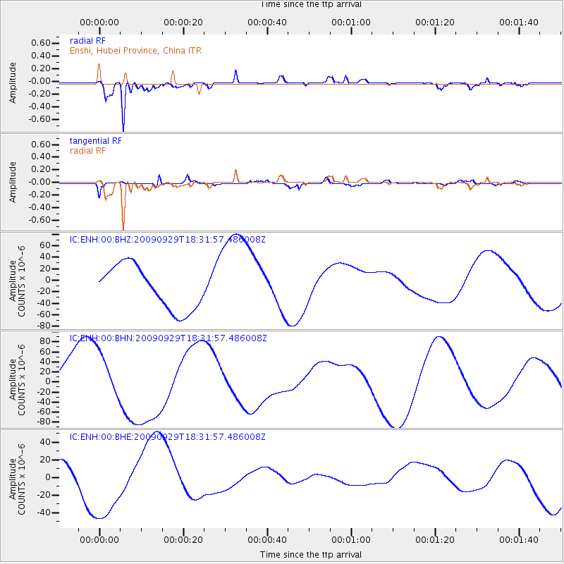
ENH Enshi, Hubei Province, China - Earthquake Result Viewer
*The percent match for this event was below the threshold and hence no stack was calculated.
| Earthquake location: |
Samoa Islands Region |
| Earthquake latitude/longitude: |
-15.9/-171.7 |
| Earthquake time(UTC): |
2009/09/29 (272) 18:19:35 GMT |
| Earthquake Depth: |
10 km |
| Earthquake Magnitude: |
5.6 MB |
| Earthquake Catalog/Contributor: |
WHDF/NEIC |
|
| Network: |
IC New China Digital Seismograph Network |
| Station: |
ENH Enshi, Hubei Province, China |
| Lat/Lon: |
30.27 N/109.49 E |
| Elevation: |
487 m |
|
| Distance: |
88.6 deg |
| Az: |
301.893 deg |
| Baz: |
109.239 deg |
| Ray Param: |
$rayparam |
*The percent match for this event was below the threshold and hence was not used in the summary stack. |
|
| Radial Match: |
88.97507 % |
| Radial Bump: |
349 |
| Transverse Match: |
81.939285 % |
| Transverse Bump: |
400 |
| SOD ConfigId: |
2622 |
| Insert Time: |
2010-03-04 22:00:28.013 +0000 |
| GWidth: |
2.5 |
| Max Bumps: |
400 |
| Tol: |
0.001 |
|
Signal To Noise
| Channel | StoN | STA | LTA |
| IC:ENH:00:BHN:20090929T18:31:57.486008Z | 1.1218071 | 4.6639245E-5 | 4.1575102E-5 |
| IC:ENH:00:BHE:20090929T18:31:57.486008Z | 3.6418097 | 4.5400946E-5 | 1.2466589E-5 |
| IC:ENH:00:BHZ:20090929T18:31:57.486008Z | 2.2904527 | 8.6031025E-5 | 3.7560705E-5 |
| Arrivals |
| Ps | |
| PpPs | |
| PsPs/PpSs | |


