You are here: Home > Network List > IC - New China Digital Seismograph Network Stations List
> Station ENH Enshi, Hubei Province, China > Earthquake Result Viewer
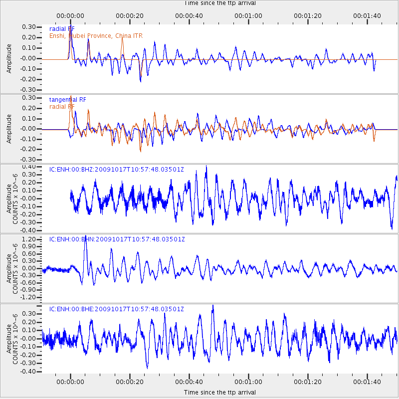
ENH Enshi, Hubei Province, China - Earthquake Result Viewer
*The percent match for this event was below the threshold and hence no stack was calculated.
| Earthquake location: |
Samoa Islands Region |
| Earthquake latitude/longitude: |
-16.4/-172.0 |
| Earthquake time(UTC): |
2009/10/17 (290) 10:45:26 GMT |
| Earthquake Depth: |
10 km |
| Earthquake Magnitude: |
5.7 MB, 5.3 MS, 5.7 MW, 5.7 MW |
| Earthquake Catalog/Contributor: |
WHDF/NEIC |
|
| Network: |
IC New China Digital Seismograph Network |
| Station: |
ENH Enshi, Hubei Province, China |
| Lat/Lon: |
30.27 N/109.49 E |
| Elevation: |
487 m |
|
| Distance: |
88.6 deg |
| Az: |
301.996 deg |
| Baz: |
109.763 deg |
| Ray Param: |
$rayparam |
*The percent match for this event was below the threshold and hence was not used in the summary stack. |
|
| Radial Match: |
78.518394 % |
| Radial Bump: |
400 |
| Transverse Match: |
77.84177 % |
| Transverse Bump: |
400 |
| SOD ConfigId: |
2622 |
| Insert Time: |
2010-03-04 22:00:37.163 +0000 |
| GWidth: |
2.5 |
| Max Bumps: |
400 |
| Tol: |
0.001 |
|
Signal To Noise
| Channel | StoN | STA | LTA |
| IC:ENH:00:BHN:20091017T10:57:48.03501Z | 3.1300716 | 3.287337E-7 | 1.05024334E-7 |
| IC:ENH:00:BHE:20091017T10:57:48.03501Z | 1.072414 | 8.1303156E-8 | 7.581322E-8 |
| IC:ENH:00:BHZ:20091017T10:57:48.03501Z | 0.93013495 | 8.846217E-8 | 9.510681E-8 |
| Arrivals |
| Ps | |
| PpPs | |
| PsPs/PpSs | |


