You are here: Home > Network List > TA - USArray Transportable Network (new EarthScope stations) Stations List
> Station 121A Cookes Peak, Deming, NM, USA > Earthquake Result Viewer
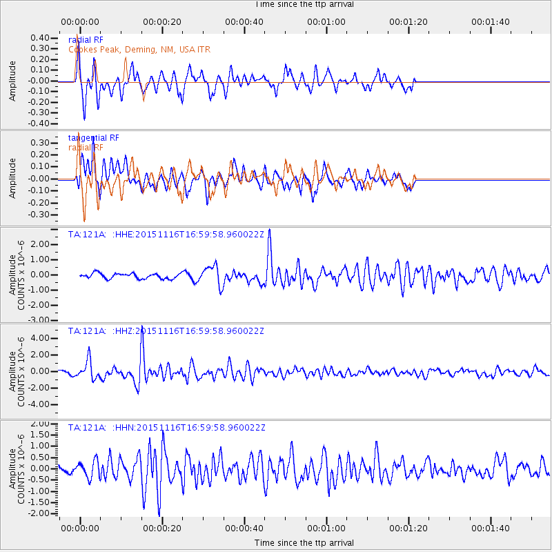
121A Cookes Peak, Deming, NM, USA - Earthquake Result Viewer
*The percent match for this event was below the threshold and hence no stack was calculated.
| Earthquake location: |
Kuril Islands |
| Earthquake latitude/longitude: |
48.3/154.3 |
| Earthquake time(UTC): |
2015/11/16 (320) 16:49:15 GMT |
| Earthquake Depth: |
42 km |
| Earthquake Magnitude: |
5.8 MWB |
| Earthquake Catalog/Contributor: |
NEIC PDE/NEIC COMCAT |
|
| Network: |
TA USArray Transportable Network (new EarthScope stations) |
| Station: |
121A Cookes Peak, Deming, NM, USA |
| Lat/Lon: |
32.53 N/107.79 W |
| Elevation: |
1652 m |
|
| Distance: |
71.3 deg |
| Az: |
62.024 deg |
| Baz: |
315.721 deg |
| Ray Param: |
$rayparam |
*The percent match for this event was below the threshold and hence was not used in the summary stack. |
|
| Radial Match: |
71.741035 % |
| Radial Bump: |
358 |
| Transverse Match: |
74.01382 % |
| Transverse Bump: |
379 |
| SOD ConfigId: |
7422571 |
| Insert Time: |
2019-04-21 09:36:17.676 +0000 |
| GWidth: |
2.5 |
| Max Bumps: |
400 |
| Tol: |
0.001 |
|
Signal To Noise
| Channel | StoN | STA | LTA |
| TA:121A: :HHZ:20151116T16:59:58.960022Z | 3.6401148 | 1.1362616E-6 | 3.1214995E-7 |
| TA:121A: :HHN:20151116T16:59:58.960022Z | 1.2673552 | 3.8551843E-7 | 3.041913E-7 |
| TA:121A: :HHE:20151116T16:59:58.960022Z | 3.6917808 | 6.7449474E-7 | 1.8270173E-7 |
| Arrivals |
| Ps | |
| PpPs | |
| PsPs/PpSs | |


