You are here: Home > Network List > TA - USArray Transportable Network (new EarthScope stations) Stations List
> Station T25A Trinidad, CO, USA > Earthquake Result Viewer
T25A Trinidad, CO, USA - Earthquake Result Viewer
*The percent match for this event was below the threshold and hence no stack was calculated.
| Earthquake location: |
Kuril Islands |
| Earthquake latitude/longitude: |
48.3/154.3 |
| Earthquake time(UTC): |
2015/11/16 (320) 16:49:15 GMT |
| Earthquake Depth: |
42 km |
| Earthquake Magnitude: |
5.8 MWB |
| Earthquake Catalog/Contributor: |
NEIC PDE/NEIC COMCAT |
|
| Network: |
TA USArray Transportable Network (new EarthScope stations) |
| Station: |
T25A Trinidad, CO, USA |
| Lat/Lon: |
37.14 N/104.41 W |
| Elevation: |
2017 m |
|
| Distance: |
70.0 deg |
| Az: |
56.519 deg |
| Baz: |
315.815 deg |
| Ray Param: |
$rayparam |
*The percent match for this event was below the threshold and hence was not used in the summary stack. |
|
| Radial Match: |
71.42445 % |
| Radial Bump: |
397 |
| Transverse Match: |
63.77776 % |
| Transverse Bump: |
400 |
| SOD ConfigId: |
7422571 |
| Insert Time: |
2019-04-21 09:37:13.732 +0000 |
| GWidth: |
2.5 |
| Max Bumps: |
400 |
| Tol: |
0.001 |
|
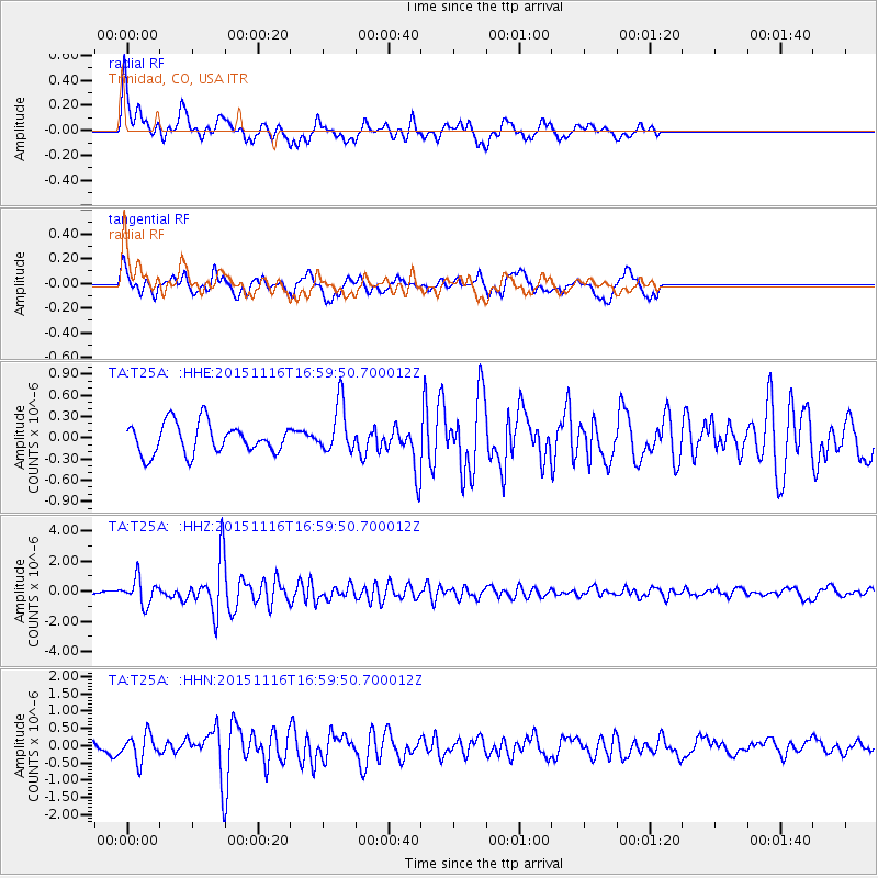
Signal To Noise
| Channel | StoN | STA | LTA |
| TA:T25A: :HHZ:20151116T16:59:50.700012Z | 9.315149 | 8.382528E-7 | 8.998812E-8 |
| TA:T25A: :HHN:20151116T16:59:50.700012Z | 2.8882277 | 3.7901336E-7 | 1.3122695E-7 |
| TA:T25A: :HHE:20151116T16:59:50.700012Z | 1.635782 | 3.4893603E-7 | 2.133145E-7 |
| Arrivals |
| Ps | |
| PpPs | |
| PsPs/PpSs | |


