You are here: Home > Network List > IC - New China Digital Seismograph Network Stations List
> Station ENH Enshi, Hubei Province, China > Earthquake Result Viewer
ENH Enshi, Hubei Province, China - Earthquake Result Viewer
*The percent match for this event was below the threshold and hence no stack was calculated.
| Earthquake location: |
Tonga Islands Region |
| Earthquake latitude/longitude: |
-22.9/-175.2 |
| Earthquake time(UTC): |
2008/12/01 (336) 20:21:34 GMT |
| Earthquake Depth: |
39 km |
| Earthquake Magnitude: |
5.5 MB, 5.1 MS |
| Earthquake Catalog/Contributor: |
WHDF/NEIC |
|
| Network: |
IC New China Digital Seismograph Network |
| Station: |
ENH Enshi, Hubei Province, China |
| Lat/Lon: |
30.27 N/109.49 E |
| Elevation: |
487 m |
|
| Distance: |
89.6 deg |
| Az: |
303.185 deg |
| Baz: |
116.901 deg |
| Ray Param: |
$rayparam |
*The percent match for this event was below the threshold and hence was not used in the summary stack. |
|
| Radial Match: |
62.299007 % |
| Radial Bump: |
400 |
| Transverse Match: |
66.027916 % |
| Transverse Bump: |
400 |
| SOD ConfigId: |
2658 |
| Insert Time: |
2010-03-04 22:01:01.928 +0000 |
| GWidth: |
2.5 |
| Max Bumps: |
400 |
| Tol: |
0.001 |
|
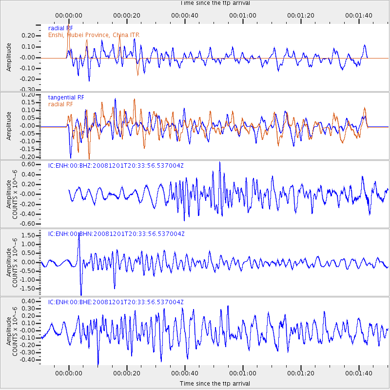
Signal To Noise
| Channel | StoN | STA | LTA |
| IC:ENH:00:BHN:20081201T20:33:56.537004Z | 7.7329144 | 7.0074157E-7 | 9.061804E-8 |
| IC:ENH:00:BHE:20081201T20:33:56.537004Z | 1.7013423 | 1.1119495E-7 | 6.535719E-8 |
| IC:ENH:00:BHZ:20081201T20:33:56.537004Z | 1.9747018 | 1.6445753E-7 | 8.328222E-8 |
| Arrivals |
| Ps | |
| PpPs | |
| PsPs/PpSs | |


