You are here: Home > Network List > TA - USArray Transportable Network (new EarthScope stations) Stations List
> Station M54A Oil Creek State Park, Oil City, PA, USA > Earthquake Result Viewer
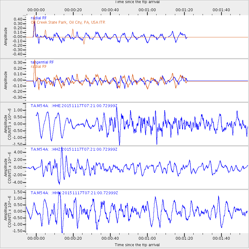
M54A Oil Creek State Park, Oil City, PA, USA - Earthquake Result Viewer
*The percent match for this event was below the threshold and hence no stack was calculated.
| Earthquake location: |
Greece |
| Earthquake latitude/longitude: |
38.8/20.6 |
| Earthquake time(UTC): |
2015/11/17 (321) 07:10:08 GMT |
| Earthquake Depth: |
11 km |
| Earthquake Magnitude: |
6.5 MWB |
| Earthquake Catalog/Contributor: |
NEIC PDE/NEIC COMCAT |
|
| Network: |
TA USArray Transportable Network (new EarthScope stations) |
| Station: |
M54A Oil Creek State Park, Oil City, PA, USA |
| Lat/Lon: |
41.51 N/79.66 W |
| Elevation: |
488 m |
|
| Distance: |
72.1 deg |
| Az: |
309.033 deg |
| Baz: |
53.964 deg |
| Ray Param: |
$rayparam |
*The percent match for this event was below the threshold and hence was not used in the summary stack. |
|
| Radial Match: |
72.69178 % |
| Radial Bump: |
400 |
| Transverse Match: |
59.13963 % |
| Transverse Bump: |
320 |
| SOD ConfigId: |
7422571 |
| Insert Time: |
2019-04-21 09:48:55.069 +0000 |
| GWidth: |
2.5 |
| Max Bumps: |
400 |
| Tol: |
0.001 |
|
Signal To Noise
| Channel | StoN | STA | LTA |
| TA:M54A: :HHZ:20151117T07:21:00.72999Z | 2.2828174 | 1.0228052E-6 | 4.4804514E-7 |
| TA:M54A: :HHN:20151117T07:21:00.72999Z | 1.3835452 | 5.5177946E-7 | 3.9881567E-7 |
| TA:M54A: :HHE:20151117T07:21:00.72999Z | 0.5427225 | 2.796125E-7 | 5.152034E-7 |
| Arrivals |
| Ps | |
| PpPs | |
| PsPs/PpSs | |


