You are here: Home > Network List > TA - USArray Transportable Network (new EarthScope stations) Stations List
> Station O48A Farmland, IN, USA > Earthquake Result Viewer
O48A Farmland, IN, USA - Earthquake Result Viewer
*The percent match for this event was below the threshold and hence no stack was calculated.
| Earthquake location: |
Greece |
| Earthquake latitude/longitude: |
38.8/20.6 |
| Earthquake time(UTC): |
2015/11/17 (321) 07:10:08 GMT |
| Earthquake Depth: |
11 km |
| Earthquake Magnitude: |
6.5 MWB |
| Earthquake Catalog/Contributor: |
NEIC PDE/NEIC COMCAT |
|
| Network: |
TA USArray Transportable Network (new EarthScope stations) |
| Station: |
O48A Farmland, IN, USA |
| Lat/Lon: |
40.26 N/85.16 W |
| Elevation: |
300 m |
|
| Distance: |
76.2 deg |
| Az: |
310.645 deg |
| Baz: |
50.824 deg |
| Ray Param: |
$rayparam |
*The percent match for this event was below the threshold and hence was not used in the summary stack. |
|
| Radial Match: |
72.03042 % |
| Radial Bump: |
317 |
| Transverse Match: |
64.82229 % |
| Transverse Bump: |
400 |
| SOD ConfigId: |
7422571 |
| Insert Time: |
2019-04-21 09:49:00.387 +0000 |
| GWidth: |
2.5 |
| Max Bumps: |
400 |
| Tol: |
0.001 |
|
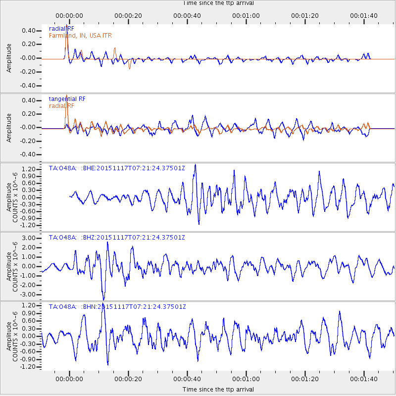
Signal To Noise
| Channel | StoN | STA | LTA |
| TA:O48A: :BHZ:20151117T07:21:24.37501Z | 2.4453733 | 6.3316776E-7 | 2.5892479E-7 |
| TA:O48A: :BHN:20151117T07:21:24.37501Z | 1.8374366 | 4.6841404E-7 | 2.54928E-7 |
| TA:O48A: :BHE:20151117T07:21:24.37501Z | 1.9299955 | 2.8256366E-7 | 1.4640638E-7 |
| Arrivals |
| Ps | |
| PpPs | |
| PsPs/PpSs | |


