You are here: Home > Network List > TA - USArray Transportable Network (new EarthScope stations) Stations List
> Station X43A Marvell, AR, USA > Earthquake Result Viewer
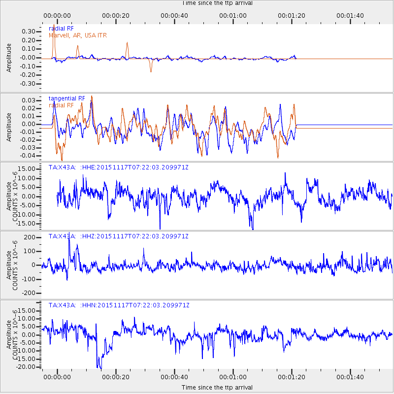
X43A Marvell, AR, USA - Earthquake Result Viewer
*The percent match for this event was below the threshold and hence no stack was calculated.
| Earthquake location: |
Greece |
| Earthquake latitude/longitude: |
38.8/20.6 |
| Earthquake time(UTC): |
2015/11/17 (321) 07:10:08 GMT |
| Earthquake Depth: |
11 km |
| Earthquake Magnitude: |
6.5 MWB |
| Earthquake Catalog/Contributor: |
NEIC PDE/NEIC COMCAT |
|
| Network: |
TA USArray Transportable Network (new EarthScope stations) |
| Station: |
X43A Marvell, AR, USA |
| Lat/Lon: |
34.52 N/90.88 W |
| Elevation: |
53 m |
|
| Distance: |
83.4 deg |
| Az: |
309.302 deg |
| Baz: |
47.116 deg |
| Ray Param: |
$rayparam |
*The percent match for this event was below the threshold and hence was not used in the summary stack. |
|
| Radial Match: |
53.632195 % |
| Radial Bump: |
330 |
| Transverse Match: |
36.747818 % |
| Transverse Bump: |
400 |
| SOD ConfigId: |
7422571 |
| Insert Time: |
2019-04-21 09:49:12.298 +0000 |
| GWidth: |
2.5 |
| Max Bumps: |
400 |
| Tol: |
0.001 |
|
Signal To Noise
| Channel | StoN | STA | LTA |
| TA:X43A: :HHZ:20151117T07:22:03.209971Z | 2.0364041 | 5.515741E-5 | 2.7085689E-5 |
| TA:X43A: :HHN:20151117T07:22:03.209971Z | 1.9179847 | 5.4065613E-6 | 2.8188763E-6 |
| TA:X43A: :HHE:20151117T07:22:03.209971Z | 1.1255155 | 4.7169897E-6 | 4.1909593E-6 |
| Arrivals |
| Ps | |
| PpPs | |
| PsPs/PpSs | |


