You are here: Home > Network List > US - United States National Seismic Network Stations List
> Station AMTX Amarillo, Texas, USA > Earthquake Result Viewer
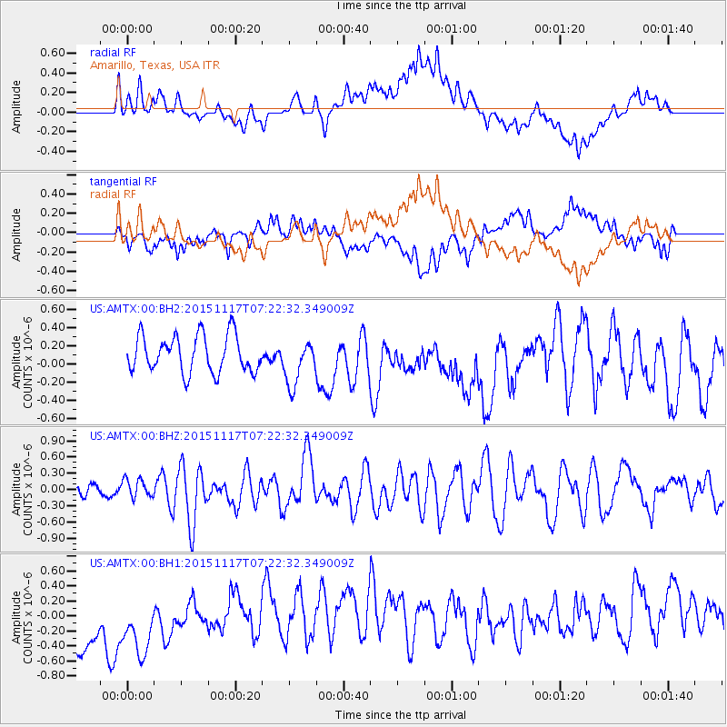
AMTX Amarillo, Texas, USA - Earthquake Result Viewer
*The percent match for this event was below the threshold and hence no stack was calculated.
| Earthquake location: |
Greece |
| Earthquake latitude/longitude: |
38.8/20.6 |
| Earthquake time(UTC): |
2015/11/17 (321) 07:10:08 GMT |
| Earthquake Depth: |
11 km |
| Earthquake Magnitude: |
6.5 MWB |
| Earthquake Catalog/Contributor: |
NEIC PDE/NEIC COMCAT |
|
| Network: |
US United States National Seismic Network |
| Station: |
AMTX Amarillo, Texas, USA |
| Lat/Lon: |
34.53 N/101.41 W |
| Elevation: |
1010 m |
|
| Distance: |
89.4 deg |
| Az: |
315.534 deg |
| Baz: |
41.559 deg |
| Ray Param: |
$rayparam |
*The percent match for this event was below the threshold and hence was not used in the summary stack. |
|
| Radial Match: |
40.28534 % |
| Radial Bump: |
400 |
| Transverse Match: |
35.100574 % |
| Transverse Bump: |
400 |
| SOD ConfigId: |
7422571 |
| Insert Time: |
2019-04-21 09:49:38.366 +0000 |
| GWidth: |
2.5 |
| Max Bumps: |
400 |
| Tol: |
0.001 |
|
Signal To Noise
| Channel | StoN | STA | LTA |
| US:AMTX:00:BHZ:20151117T07:22:32.349009Z | 1.0446166 | 1.6831237E-7 | 1.6112358E-7 |
| US:AMTX:00:BH1:20151117T07:22:32.349009Z | 0.85779595 | 7.1752737E-7 | 8.364779E-7 |
| US:AMTX:00:BH2:20151117T07:22:32.349009Z | 1.3200495 | 2.6381682E-7 | 1.9985374E-7 |
| Arrivals |
| Ps | |
| PpPs | |
| PsPs/PpSs | |


