You are here: Home > Network List > US - United States National Seismic Network Stations List
> Station DGMT Dagmar, Montana, USA > Earthquake Result Viewer
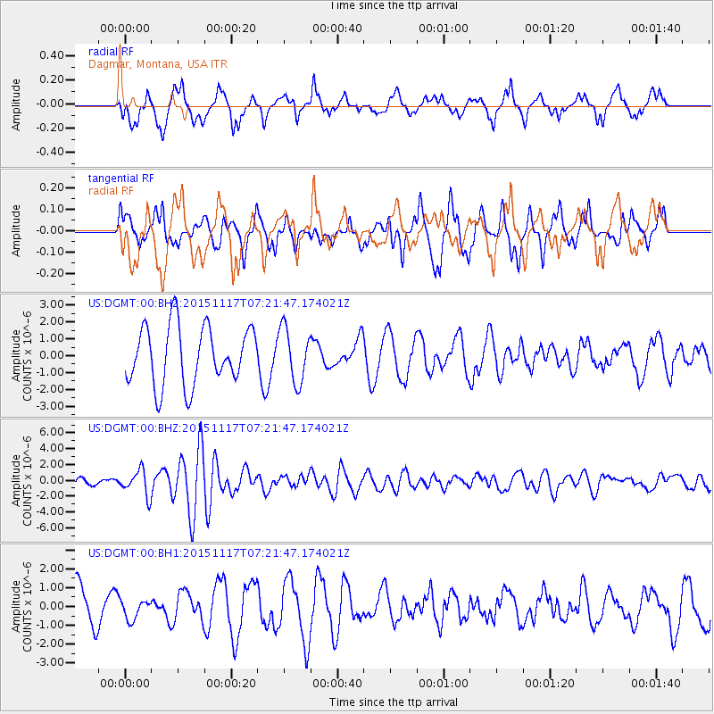
DGMT Dagmar, Montana, USA - Earthquake Result Viewer
*The percent match for this event was below the threshold and hence no stack was calculated.
| Earthquake location: |
Greece |
| Earthquake latitude/longitude: |
38.8/20.6 |
| Earthquake time(UTC): |
2015/11/17 (321) 07:10:08 GMT |
| Earthquake Depth: |
11 km |
| Earthquake Magnitude: |
6.5 MWB |
| Earthquake Catalog/Contributor: |
NEIC PDE/NEIC COMCAT |
|
| Network: |
US United States National Seismic Network |
| Station: |
DGMT Dagmar, Montana, USA |
| Lat/Lon: |
48.47 N/104.20 W |
| Elevation: |
0.0 m |
|
| Distance: |
80.3 deg |
| Az: |
326.304 deg |
| Baz: |
40.677 deg |
| Ray Param: |
$rayparam |
*The percent match for this event was below the threshold and hence was not used in the summary stack. |
|
| Radial Match: |
45.215874 % |
| Radial Bump: |
379 |
| Transverse Match: |
38.577354 % |
| Transverse Bump: |
400 |
| SOD ConfigId: |
7422571 |
| Insert Time: |
2019-04-21 09:49:40.104 +0000 |
| GWidth: |
2.5 |
| Max Bumps: |
400 |
| Tol: |
0.001 |
|
Signal To Noise
| Channel | StoN | STA | LTA |
| US:DGMT:00:BHZ:20151117T07:21:47.174021Z | 5.2425113 | 1.6378848E-6 | 3.124237E-7 |
| US:DGMT:00:BH1:20151117T07:21:47.174021Z | 0.3849429 | 5.030357E-7 | 1.3067801E-6 |
| US:DGMT:00:BH2:20151117T07:21:47.174021Z | 0.8497839 | 1.4613403E-6 | 1.7196611E-6 |
| Arrivals |
| Ps | |
| PpPs | |
| PsPs/PpSs | |


