You are here: Home > Network List > UW - Pacific Northwest Regional Seismic Network Stations List
> Station PASS Maple Falls, WA, USA > Earthquake Result Viewer
PASS Maple Falls, WA, USA - Earthquake Result Viewer
*The percent match for this event was below the threshold and hence no stack was calculated.
| Earthquake location: |
Greece |
| Earthquake latitude/longitude: |
38.8/20.6 |
| Earthquake time(UTC): |
2015/11/17 (321) 07:10:08 GMT |
| Earthquake Depth: |
11 km |
| Earthquake Magnitude: |
6.5 MWB |
| Earthquake Catalog/Contributor: |
NEIC PDE/NEIC COMCAT |
|
| Network: |
UW Pacific Northwest Regional Seismic Network |
| Station: |
PASS Maple Falls, WA, USA |
| Lat/Lon: |
49.00 N/122.09 W |
| Elevation: |
174 m |
|
| Distance: |
86.6 deg |
| Az: |
336.397 deg |
| Baz: |
28.382 deg |
| Ray Param: |
$rayparam |
*The percent match for this event was below the threshold and hence was not used in the summary stack. |
|
| Radial Match: |
39.34333 % |
| Radial Bump: |
400 |
| Transverse Match: |
36.58883 % |
| Transverse Bump: |
400 |
| SOD ConfigId: |
7422571 |
| Insert Time: |
2019-04-21 09:50:02.081 +0000 |
| GWidth: |
2.5 |
| Max Bumps: |
400 |
| Tol: |
0.001 |
|
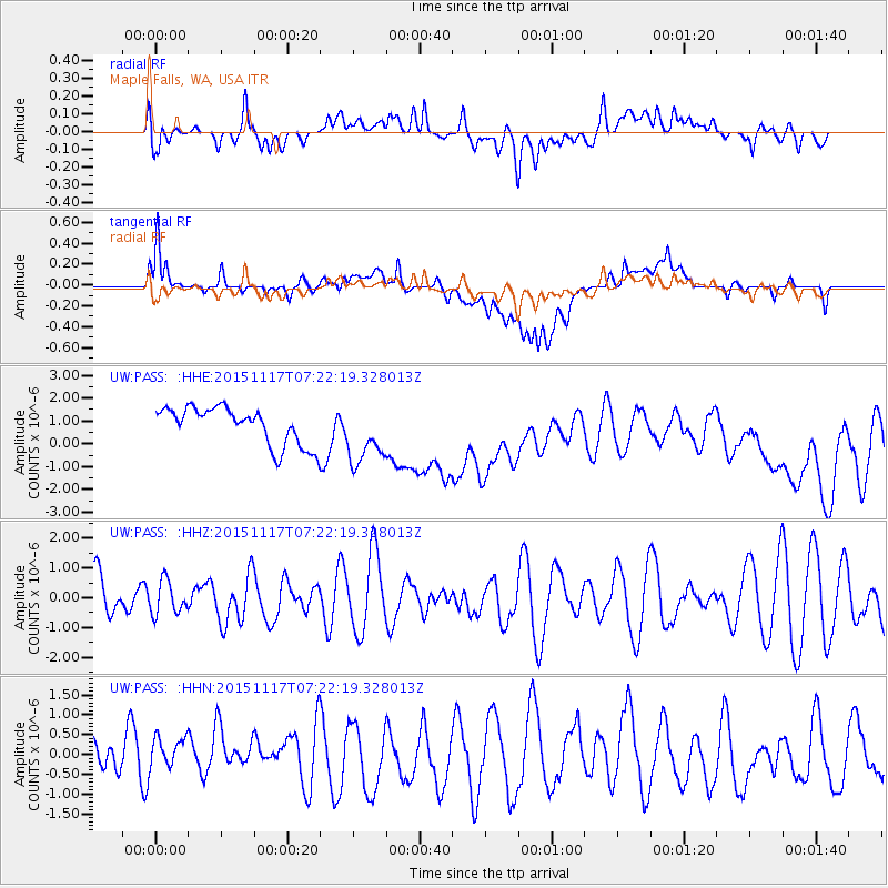
Signal To Noise
| Channel | StoN | STA | LTA |
| UW:PASS: :HHZ:20151117T07:22:19.328013Z | 0.69577235 | 5.541657E-7 | 7.964756E-7 |
| UW:PASS: :HHN:20151117T07:22:19.328013Z | 0.84112567 | 4.5992854E-7 | 5.4680123E-7 |
| UW:PASS: :HHE:20151117T07:22:19.328013Z | 1.3517367 | 1.2151036E-6 | 8.9892035E-7 |
| Arrivals |
| Ps | |
| PpPs | |
| PsPs/PpSs | |


