You are here: Home > Network List > UW - Pacific Northwest Regional Seismic Network Stations List
> Station MRBL Marblemount, WA, USA > Earthquake Result Viewer
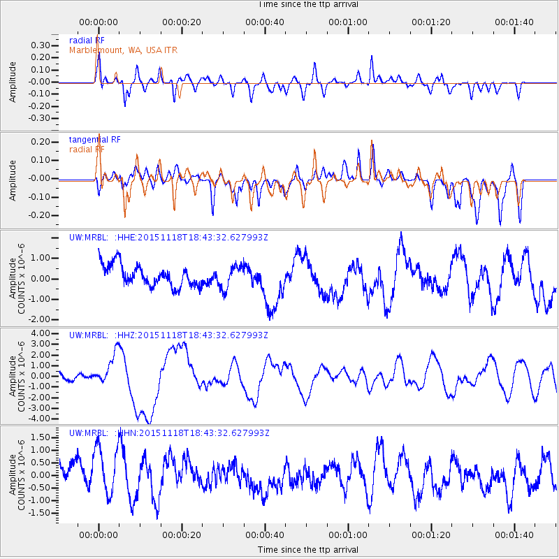
MRBL Marblemount, WA, USA - Earthquake Result Viewer
*The percent match for this event was below the threshold and hence no stack was calculated.
| Earthquake location: |
Solomon Islands |
| Earthquake latitude/longitude: |
-8.9/158.4 |
| Earthquake time(UTC): |
2015/11/18 (322) 18:31:04 GMT |
| Earthquake Depth: |
11 km |
| Earthquake Magnitude: |
6.8 MWB, 7.0 MI |
| Earthquake Catalog/Contributor: |
NEIC PDE/NEIC COMCAT |
|
| Network: |
UW Pacific Northwest Regional Seismic Network |
| Station: |
MRBL Marblemount, WA, USA |
| Lat/Lon: |
48.52 N/121.48 W |
| Elevation: |
75 m |
|
| Distance: |
90.1 deg |
| Az: |
40.917 deg |
| Baz: |
256.723 deg |
| Ray Param: |
$rayparam |
*The percent match for this event was below the threshold and hence was not used in the summary stack. |
|
| Radial Match: |
73.728386 % |
| Radial Bump: |
400 |
| Transverse Match: |
42.185257 % |
| Transverse Bump: |
400 |
| SOD ConfigId: |
7422571 |
| Insert Time: |
2019-04-21 10:07:31.893 +0000 |
| GWidth: |
2.5 |
| Max Bumps: |
400 |
| Tol: |
0.001 |
|
Signal To Noise
| Channel | StoN | STA | LTA |
| UW:MRBL: :HHZ:20151118T18:43:32.627993Z | 3.7151597 | 1.5451233E-6 | 4.1589686E-7 |
| UW:MRBL: :HHN:20151118T18:43:32.627993Z | 1.3274376 | 1.2078257E-6 | 9.0989255E-7 |
| UW:MRBL: :HHE:20151118T18:43:32.627993Z | 1.1090505 | 5.674301E-7 | 5.1163596E-7 |
| Arrivals |
| Ps | |
| PpPs | |
| PsPs/PpSs | |


