You are here: Home > Network List > CI - Caltech Regional Seismic Network Stations List
> Station LRL Laurel Mtn Radio Fac, Ridgecrest, CA, USA > Earthquake Result Viewer
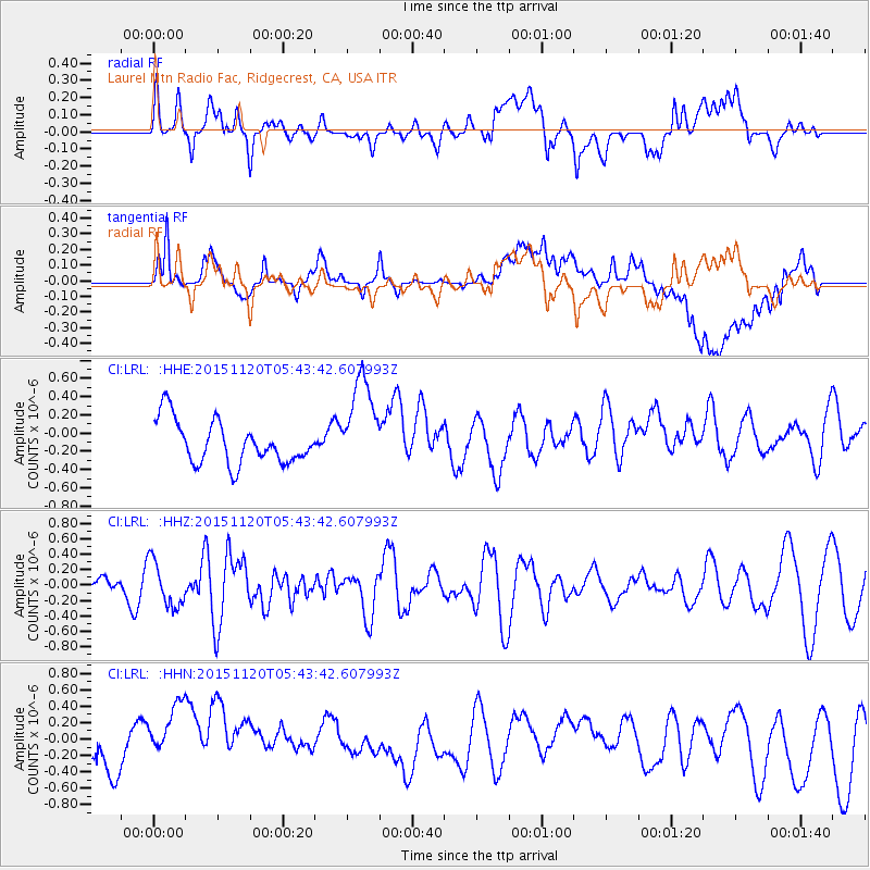
LRL Laurel Mtn Radio Fac, Ridgecrest, CA, USA - Earthquake Result Viewer
*The percent match for this event was below the threshold and hence no stack was calculated.
| Earthquake location: |
Bonin Islands, Japan Region |
| Earthquake latitude/longitude: |
26.4/142.7 |
| Earthquake time(UTC): |
2015/11/20 (324) 05:31:52 GMT |
| Earthquake Depth: |
13 km |
| Earthquake Magnitude: |
5.5 MB |
| Earthquake Catalog/Contributor: |
NEIC PDE/NEIC COMCAT |
|
| Network: |
CI Caltech Regional Seismic Network |
| Station: |
LRL Laurel Mtn Radio Fac, Ridgecrest, CA, USA |
| Lat/Lon: |
35.48 N/117.68 W |
| Elevation: |
1340 m |
|
| Distance: |
82.4 deg |
| Az: |
54.284 deg |
| Baz: |
296.824 deg |
| Ray Param: |
$rayparam |
*The percent match for this event was below the threshold and hence was not used in the summary stack. |
|
| Radial Match: |
53.139038 % |
| Radial Bump: |
400 |
| Transverse Match: |
49.08007 % |
| Transverse Bump: |
400 |
| SOD ConfigId: |
7422571 |
| Insert Time: |
2019-04-21 10:12:36.888 +0000 |
| GWidth: |
2.5 |
| Max Bumps: |
400 |
| Tol: |
0.001 |
|
Signal To Noise
| Channel | StoN | STA | LTA |
| CI:LRL: :HHZ:20151120T05:43:42.607993Z | 2.941083 | 2.9136558E-7 | 9.906745E-8 |
| CI:LRL: :HHN:20151120T05:43:42.607993Z | 2.2246583 | 6.245801E-7 | 2.8075326E-7 |
| CI:LRL: :HHE:20151120T05:43:42.607993Z | 2.1946402 | 5.176821E-7 | 2.3588474E-7 |
| Arrivals |
| Ps | |
| PpPs | |
| PsPs/PpSs | |


