You are here: Home > Network List > TA - USArray Transportable Network (new EarthScope stations) Stations List
> Station J05D Fort Rock, OR, USA > Earthquake Result Viewer
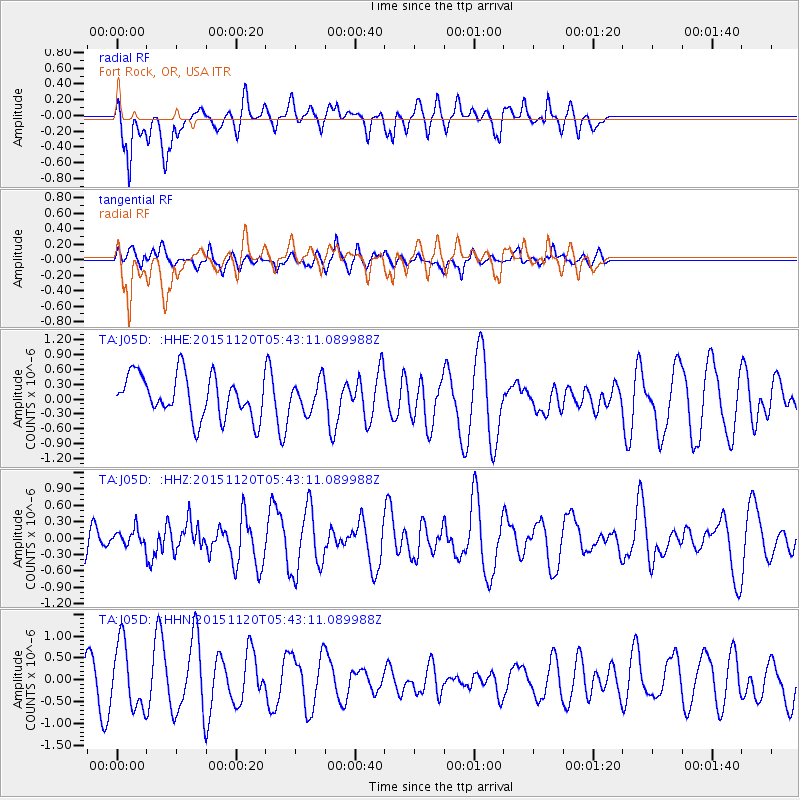
J05D Fort Rock, OR, USA - Earthquake Result Viewer
*The percent match for this event was below the threshold and hence no stack was calculated.
| Earthquake location: |
Bonin Islands, Japan Region |
| Earthquake latitude/longitude: |
26.4/142.7 |
| Earthquake time(UTC): |
2015/11/20 (324) 05:31:52 GMT |
| Earthquake Depth: |
13 km |
| Earthquake Magnitude: |
5.5 MB |
| Earthquake Catalog/Contributor: |
NEIC PDE/NEIC COMCAT |
|
| Network: |
TA USArray Transportable Network (new EarthScope stations) |
| Station: |
J05D Fort Rock, OR, USA |
| Lat/Lon: |
43.28 N/121.23 W |
| Elevation: |
1541 m |
|
| Distance: |
76.5 deg |
| Az: |
48.303 deg |
| Baz: |
293.475 deg |
| Ray Param: |
$rayparam |
*The percent match for this event was below the threshold and hence was not used in the summary stack. |
|
| Radial Match: |
61.04318 % |
| Radial Bump: |
400 |
| Transverse Match: |
33.784702 % |
| Transverse Bump: |
400 |
| SOD ConfigId: |
7422571 |
| Insert Time: |
2019-04-21 10:16:32.613 +0000 |
| GWidth: |
2.5 |
| Max Bumps: |
400 |
| Tol: |
0.001 |
|
Signal To Noise
| Channel | StoN | STA | LTA |
| TA:J05D: :HHZ:20151120T05:43:11.089988Z | 0.3855244 | 1.5374684E-7 | 3.9879927E-7 |
| TA:J05D: :HHN:20151120T05:43:11.089988Z | 2.2172143 | 7.431373E-7 | 3.351671E-7 |
| TA:J05D: :HHE:20151120T05:43:11.089988Z | 0.68631166 | 2.9717367E-7 | 4.3300102E-7 |
| Arrivals |
| Ps | |
| PpPs | |
| PsPs/PpSs | |


