You are here: Home > Network List > TA - USArray Transportable Network (new EarthScope stations) Stations List
> Station MDND Maddock, ND, USA > Earthquake Result Viewer
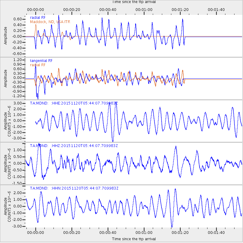
MDND Maddock, ND, USA - Earthquake Result Viewer
*The percent match for this event was below the threshold and hence no stack was calculated.
| Earthquake location: |
Bonin Islands, Japan Region |
| Earthquake latitude/longitude: |
26.4/142.7 |
| Earthquake time(UTC): |
2015/11/20 (324) 05:31:52 GMT |
| Earthquake Depth: |
13 km |
| Earthquake Magnitude: |
5.5 MB |
| Earthquake Catalog/Contributor: |
NEIC PDE/NEIC COMCAT |
|
| Network: |
TA USArray Transportable Network (new EarthScope stations) |
| Station: |
MDND Maddock, ND, USA |
| Lat/Lon: |
47.85 N/99.60 W |
| Elevation: |
479 m |
|
| Distance: |
87.4 deg |
| Az: |
36.659 deg |
| Baz: |
307.331 deg |
| Ray Param: |
$rayparam |
*The percent match for this event was below the threshold and hence was not used in the summary stack. |
|
| Radial Match: |
53.095463 % |
| Radial Bump: |
320 |
| Transverse Match: |
67.51813 % |
| Transverse Bump: |
400 |
| SOD ConfigId: |
7422571 |
| Insert Time: |
2019-04-21 10:16:41.458 +0000 |
| GWidth: |
2.5 |
| Max Bumps: |
400 |
| Tol: |
0.001 |
|
Signal To Noise
| Channel | StoN | STA | LTA |
| TA:MDND: :HHZ:20151120T05:44:07.709983Z | 2.23532 | 9.450509E-7 | 4.2278103E-7 |
| TA:MDND: :HHN:20151120T05:44:07.709983Z | 1.0071487 | 1.4224635E-6 | 1.4123668E-6 |
| TA:MDND: :HHE:20151120T05:44:07.709983Z | 1.0275723 | 1.1161693E-6 | 1.0862198E-6 |
| Arrivals |
| Ps | |
| PpPs | |
| PsPs/PpSs | |


