You are here: Home > Network List > TA - USArray Transportable Network (new EarthScope stations) Stations List
> Station J20K Nowitna River, AK, USA > Earthquake Result Viewer
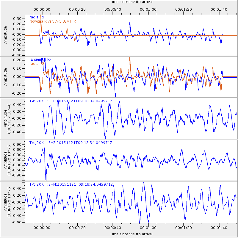
J20K Nowitna River, AK, USA - Earthquake Result Viewer
*The percent match for this event was below the threshold and hence no stack was calculated.
| Earthquake location: |
Banda Sea |
| Earthquake latitude/longitude: |
-7.2/129.9 |
| Earthquake time(UTC): |
2015/11/21 (325) 09:06:12 GMT |
| Earthquake Depth: |
67 km |
| Earthquake Magnitude: |
6.1 MWP |
| Earthquake Catalog/Contributor: |
NEIC PDE/NEIC COMCAT |
|
| Network: |
TA USArray Transportable Network (new EarthScope stations) |
| Station: |
J20K Nowitna River, AK, USA |
| Lat/Lon: |
64.18 N/154.15 W |
| Elevation: |
314 m |
|
| Distance: |
90.4 deg |
| Az: |
25.14 deg |
| Baz: |
254.248 deg |
| Ray Param: |
$rayparam |
*The percent match for this event was below the threshold and hence was not used in the summary stack. |
|
| Radial Match: |
44.54334 % |
| Radial Bump: |
400 |
| Transverse Match: |
60.430286 % |
| Transverse Bump: |
400 |
| SOD ConfigId: |
7422571 |
| Insert Time: |
2019-04-21 10:21:45.839 +0000 |
| GWidth: |
2.5 |
| Max Bumps: |
400 |
| Tol: |
0.001 |
|
Signal To Noise
| Channel | StoN | STA | LTA |
| TA:J20K: :BHZ:20151121T09:18:34.049971Z | 3.9836133 | 5.188766E-7 | 1.3025276E-7 |
| TA:J20K: :BHN:20151121T09:18:34.049971Z | 1.1893892 | 1.6429995E-7 | 1.3813808E-7 |
| TA:J20K: :BHE:20151121T09:18:34.049971Z | 0.7697846 | 2.0939932E-7 | 2.7202324E-7 |
| Arrivals |
| Ps | |
| PpPs | |
| PsPs/PpSs | |


