You are here: Home > Network List > GS - US Geological Survey Networks Stations List
> Station DEC06 Boomer, Decatur, IL, USA > Earthquake Result Viewer
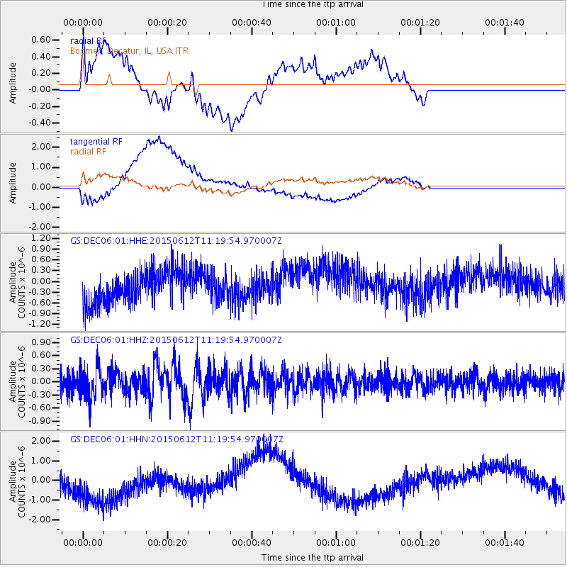
DEC06 Boomer, Decatur, IL, USA - Earthquake Result Viewer
*The percent match for this event was below the threshold and hence no stack was calculated.
| Earthquake location: |
Samoa Islands Region |
| Earthquake latitude/longitude: |
-15.6/-173.0 |
| Earthquake time(UTC): |
2015/06/12 (163) 11:07:04 GMT |
| Earthquake Depth: |
29 km |
| Earthquake Magnitude: |
6.3 MO |
| Earthquake Catalog/Contributor: |
NEIC PDE/NEIC ALERT |
|
| Network: |
GS US Geological Survey Networks |
| Station: |
DEC06 Boomer, Decatur, IL, USA |
| Lat/Lon: |
39.90 N/88.95 W |
| Elevation: |
215 m |
|
| Distance: |
95.4 deg |
| Az: |
50.225 deg |
| Baz: |
254.304 deg |
| Ray Param: |
$rayparam |
*The percent match for this event was below the threshold and hence was not used in the summary stack. |
|
| Radial Match: |
29.786312 % |
| Radial Bump: |
400 |
| Transverse Match: |
37.666798 % |
| Transverse Bump: |
400 |
| SOD ConfigId: |
976571 |
| Insert Time: |
2015-06-26 12:26:17.345 +0000 |
| GWidth: |
2.5 |
| Max Bumps: |
400 |
| Tol: |
0.001 |
|
Signal To Noise
| Channel | StoN | STA | LTA |
| GS:DEC06:01:HHZ:20150612T11:19:54.970007Z | 1.3526409 | 3.8098105E-7 | 2.816572E-7 |
| GS:DEC06:01:HHN:20150612T11:19:54.970007Z | 3.6317773 | 1.5470612E-6 | 4.2597907E-7 |
| GS:DEC06:01:HHE:20150612T11:19:54.970007Z | 0.7466994 | 3.3506348E-7 | 4.487261E-7 |
| Arrivals |
| Ps | |
| PpPs | |
| PsPs/PpSs | |


