You are here: Home > Network List > IU - Global Seismograph Network (GSN - IRIS/USGS) Stations List
> Station POHA Pohakuloa, Hawaii, USA > Earthquake Result Viewer
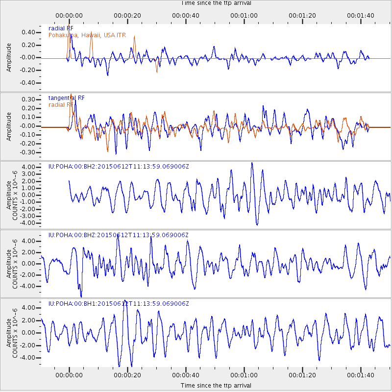
POHA Pohakuloa, Hawaii, USA - Earthquake Result Viewer
*The percent match for this event was below the threshold and hence no stack was calculated.
| Earthquake location: |
Samoa Islands Region |
| Earthquake latitude/longitude: |
-15.6/-173.0 |
| Earthquake time(UTC): |
2015/06/12 (163) 11:07:04 GMT |
| Earthquake Depth: |
29 km |
| Earthquake Magnitude: |
6.3 MO |
| Earthquake Catalog/Contributor: |
NEIC PDE/NEIC ALERT |
|
| Network: |
IU Global Seismograph Network (GSN - IRIS/USGS) |
| Station: |
POHA Pohakuloa, Hawaii, USA |
| Lat/Lon: |
19.76 N/155.53 W |
| Elevation: |
1990 m |
|
| Distance: |
39.1 deg |
| Az: |
26.625 deg |
| Baz: |
207.292 deg |
| Ray Param: |
$rayparam |
*The percent match for this event was below the threshold and hence was not used in the summary stack. |
|
| Radial Match: |
69.384964 % |
| Radial Bump: |
400 |
| Transverse Match: |
58.758244 % |
| Transverse Bump: |
400 |
| SOD ConfigId: |
976571 |
| Insert Time: |
2015-06-26 12:28:47.342 +0000 |
| GWidth: |
2.5 |
| Max Bumps: |
400 |
| Tol: |
0.001 |
|
Signal To Noise
| Channel | StoN | STA | LTA |
| IU:POHA:00:BHZ:20150612T11:13:59.069006Z | 2.4516835 | 2.8109257E-6 | 1.1465288E-6 |
| IU:POHA:00:BH1:20150612T11:13:59.069006Z | 0.7661909 | 1.248167E-6 | 1.6290549E-6 |
| IU:POHA:00:BH2:20150612T11:13:59.069006Z | 1.5514885 | 1.6659278E-6 | 1.0737609E-6 |
| Arrivals |
| Ps | |
| PpPs | |
| PsPs/PpSs | |


