You are here: Home > Network List > TA - USArray Transportable Network (new EarthScope stations) Stations List
> Station I23K Minto, Yukon-Koyukuk, AK, USA > Earthquake Result Viewer
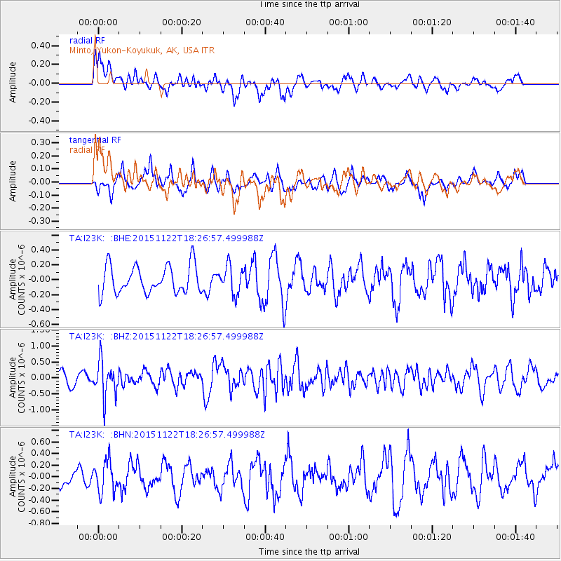
I23K Minto, Yukon-Koyukuk, AK, USA - Earthquake Result Viewer
*The percent match for this event was below the threshold and hence no stack was calculated.
| Earthquake location: |
Afghanistan-Tajikistan Bord Reg. |
| Earthquake latitude/longitude: |
36.5/71.5 |
| Earthquake time(UTC): |
2015/11/22 (326) 18:16:04 GMT |
| Earthquake Depth: |
92 km |
| Earthquake Magnitude: |
5.9 MB |
| Earthquake Catalog/Contributor: |
NEIC PDE/NEIC COMCAT |
|
| Network: |
TA USArray Transportable Network (new EarthScope stations) |
| Station: |
I23K Minto, Yukon-Koyukuk, AK, USA |
| Lat/Lon: |
65.15 N/149.36 W |
| Elevation: |
149 m |
|
| Distance: |
73.8 deg |
| Az: |
16.718 deg |
| Baz: |
326.73 deg |
| Ray Param: |
$rayparam |
*The percent match for this event was below the threshold and hence was not used in the summary stack. |
|
| Radial Match: |
55.43152 % |
| Radial Bump: |
400 |
| Transverse Match: |
65.41621 % |
| Transverse Bump: |
400 |
| SOD ConfigId: |
7422571 |
| Insert Time: |
2019-04-21 10:41:40.368 +0000 |
| GWidth: |
2.5 |
| Max Bumps: |
400 |
| Tol: |
0.001 |
|
Signal To Noise
| Channel | StoN | STA | LTA |
| TA:I23K: :BHZ:20151122T18:26:57.499988Z | 2.8286052 | 5.738365E-7 | 2.0286905E-7 |
| TA:I23K: :BHN:20151122T18:26:57.499988Z | 2.3010983 | 2.7514432E-7 | 1.1957086E-7 |
| TA:I23K: :BHE:20151122T18:26:57.499988Z | 1.0977442 | 1.9535035E-7 | 1.7795617E-7 |
| Arrivals |
| Ps | |
| PpPs | |
| PsPs/PpSs | |


