You are here: Home > Network List > TA - USArray Transportable Network (new EarthScope stations) Stations List
> Station I23K Minto, Yukon-Koyukuk, AK, USA > Earthquake Result Viewer
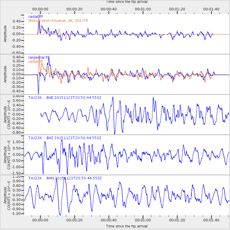
I23K Minto, Yukon-Koyukuk, AK, USA - Earthquake Result Viewer
*The percent match for this event was below the threshold and hence no stack was calculated.
| Earthquake location: |
Guerrero, Mexico |
| Earthquake latitude/longitude: |
17.1/-98.8 |
| Earthquake time(UTC): |
2015/11/23 (327) 20:41:23 GMT |
| Earthquake Depth: |
38 km |
| Earthquake Magnitude: |
5.5 MB |
| Earthquake Catalog/Contributor: |
NEIC PDE/NEIC COMCAT |
|
| Network: |
TA USArray Transportable Network (new EarthScope stations) |
| Station: |
I23K Minto, Yukon-Koyukuk, AK, USA |
| Lat/Lon: |
65.15 N/149.36 W |
| Elevation: |
149 m |
|
| Distance: |
58.5 deg |
| Az: |
337.511 deg |
| Baz: |
120.057 deg |
| Ray Param: |
$rayparam |
*The percent match for this event was below the threshold and hence was not used in the summary stack. |
|
| Radial Match: |
46.841743 % |
| Radial Bump: |
400 |
| Transverse Match: |
42.94567 % |
| Transverse Bump: |
386 |
| SOD ConfigId: |
7422571 |
| Insert Time: |
2019-04-21 10:47:51.256 +0000 |
| GWidth: |
2.5 |
| Max Bumps: |
400 |
| Tol: |
0.001 |
|
Signal To Noise
| Channel | StoN | STA | LTA |
| TA:I23K: :BHZ:20151123T20:50:44.550Z | 2.8991864 | 6.1142333E-7 | 2.1089481E-7 |
| TA:I23K: :BHN:20151123T20:50:44.550Z | 0.574323 | 1.4742393E-7 | 2.566917E-7 |
| TA:I23K: :BHE:20151123T20:50:44.550Z | 1.5493062 | 2.522571E-7 | 1.628194E-7 |
| Arrivals |
| Ps | |
| PpPs | |
| PsPs/PpSs | |


