You are here: Home > Network List > TA - USArray Transportable Network (new EarthScope stations) Stations List
> Station J26L Joseph Creek, AK, USA > Earthquake Result Viewer
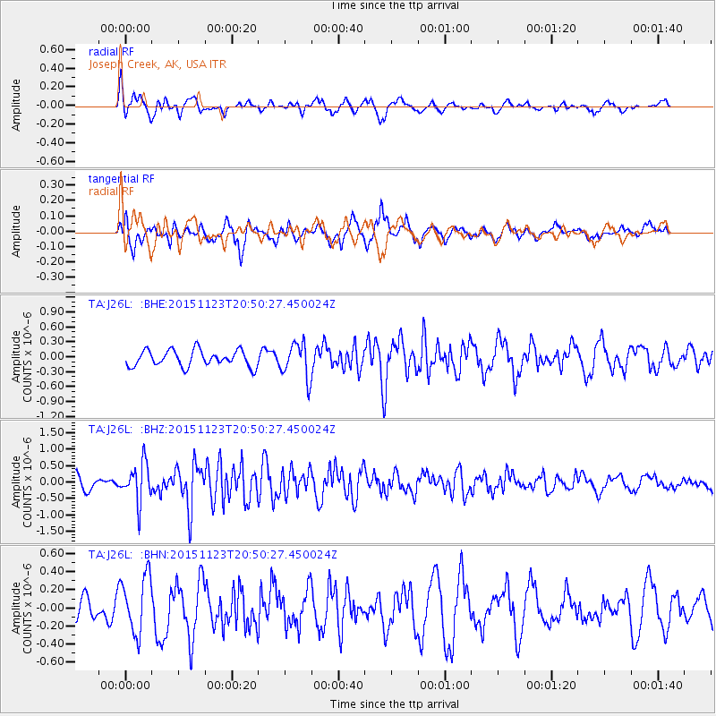
J26L Joseph Creek, AK, USA - Earthquake Result Viewer
*The percent match for this event was below the threshold and hence no stack was calculated.
| Earthquake location: |
Guerrero, Mexico |
| Earthquake latitude/longitude: |
17.1/-98.8 |
| Earthquake time(UTC): |
2015/11/23 (327) 20:41:23 GMT |
| Earthquake Depth: |
38 km |
| Earthquake Magnitude: |
5.5 MB |
| Earthquake Catalog/Contributor: |
NEIC PDE/NEIC COMCAT |
|
| Network: |
TA USArray Transportable Network (new EarthScope stations) |
| Station: |
J26L Joseph Creek, AK, USA |
| Lat/Lon: |
64.50 N/143.56 W |
| Elevation: |
1144 m |
|
| Distance: |
56.1 deg |
| Az: |
338.465 deg |
| Baz: |
125.813 deg |
| Ray Param: |
$rayparam |
*The percent match for this event was below the threshold and hence was not used in the summary stack. |
|
| Radial Match: |
49.92031 % |
| Radial Bump: |
400 |
| Transverse Match: |
66.96205 % |
| Transverse Bump: |
388 |
| SOD ConfigId: |
7422571 |
| Insert Time: |
2019-04-21 10:47:52.600 +0000 |
| GWidth: |
2.5 |
| Max Bumps: |
400 |
| Tol: |
0.001 |
|
Signal To Noise
| Channel | StoN | STA | LTA |
| TA:J26L: :BHZ:20151123T20:50:27.450024Z | 2.6606796 | 5.9209754E-7 | 2.2253622E-7 |
| TA:J26L: :BHN:20151123T20:50:27.450024Z | 2.239021 | 3.1805692E-7 | 1.4205176E-7 |
| TA:J26L: :BHE:20151123T20:50:27.450024Z | 2.1863704 | 3.5286635E-7 | 1.6139367E-7 |
| Arrivals |
| Ps | |
| PpPs | |
| PsPs/PpSs | |


