You are here: Home > Network List > UW - Pacific Northwest Regional Seismic Network Stations List
> Station HOOD Mt Hood Meadows, OR CREST BB SMO > Earthquake Result Viewer
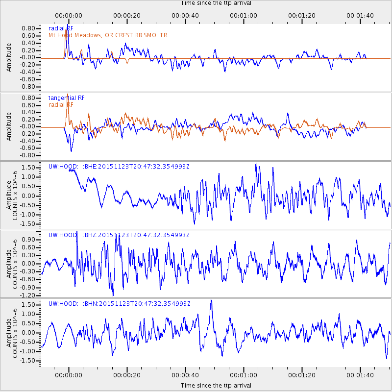
HOOD Mt Hood Meadows, OR CREST BB SMO - Earthquake Result Viewer
*The percent match for this event was below the threshold and hence no stack was calculated.
| Earthquake location: |
Guerrero, Mexico |
| Earthquake latitude/longitude: |
17.1/-98.8 |
| Earthquake time(UTC): |
2015/11/23 (327) 20:41:23 GMT |
| Earthquake Depth: |
38 km |
| Earthquake Magnitude: |
5.5 MB |
| Earthquake Catalog/Contributor: |
NEIC PDE/NEIC COMCAT |
|
| Network: |
UW Pacific Northwest Regional Seismic Network |
| Station: |
HOOD Mt Hood Meadows, OR CREST BB SMO |
| Lat/Lon: |
45.32 N/121.65 W |
| Elevation: |
1520 m |
|
| Distance: |
34.0 deg |
| Az: |
330.684 deg |
| Baz: |
138.422 deg |
| Ray Param: |
$rayparam |
*The percent match for this event was below the threshold and hence was not used in the summary stack. |
|
| Radial Match: |
59.983364 % |
| Radial Bump: |
400 |
| Transverse Match: |
45.589848 % |
| Transverse Bump: |
400 |
| SOD ConfigId: |
7422571 |
| Insert Time: |
2019-04-21 10:48:23.914 +0000 |
| GWidth: |
2.5 |
| Max Bumps: |
400 |
| Tol: |
0.001 |
|
Signal To Noise
| Channel | StoN | STA | LTA |
| UW:HOOD: :BHZ:20151123T20:47:32.354993Z | 1.5807587 | 3.7195636E-7 | 2.3530244E-7 |
| UW:HOOD: :BHN:20151123T20:47:32.354993Z | 0.89669037 | 3.383794E-7 | 3.7736484E-7 |
| UW:HOOD: :BHE:20151123T20:47:32.354993Z | 0.80320543 | 4.304488E-7 | 5.359137E-7 |
| Arrivals |
| Ps | |
| PpPs | |
| PsPs/PpSs | |


