You are here: Home > Network List > TA - USArray Transportable Network (new EarthScope stations) Stations List
> Station G03D McMinnville, OR, USA > Earthquake Result Viewer
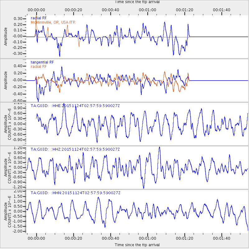
G03D McMinnville, OR, USA - Earthquake Result Viewer
*The percent match for this event was below the threshold and hence no stack was calculated.
| Earthquake location: |
South Of Tonga Islands |
| Earthquake latitude/longitude: |
-24.5/-173.8 |
| Earthquake time(UTC): |
2015/11/24 (328) 02:46:05 GMT |
| Earthquake Depth: |
15 km |
| Earthquake Magnitude: |
5.5 mwc |
| Earthquake Catalog/Contributor: |
NEIC PDE/ |
|
| Network: |
TA USArray Transportable Network (new EarthScope stations) |
| Station: |
G03D McMinnville, OR, USA |
| Lat/Lon: |
45.21 N/123.26 W |
| Elevation: |
222 m |
|
| Distance: |
83.3 deg |
| Az: |
33.352 deg |
| Baz: |
225.094 deg |
| Ray Param: |
$rayparam |
*The percent match for this event was below the threshold and hence was not used in the summary stack. |
|
| Radial Match: |
38.801292 % |
| Radial Bump: |
400 |
| Transverse Match: |
52.0928 % |
| Transverse Bump: |
400 |
| SOD ConfigId: |
7422571 |
| Insert Time: |
2019-04-21 10:54:43.812 +0000 |
| GWidth: |
2.5 |
| Max Bumps: |
400 |
| Tol: |
0.001 |
|
Signal To Noise
| Channel | StoN | STA | LTA |
| TA:G03D: :HHZ:20151124T02:57:59.590027Z | 0.91005826 | 4.326169E-7 | 4.7537276E-7 |
| TA:G03D: :HHN:20151124T02:57:59.590027Z | 1.6597134 | 6.687078E-7 | 4.0290558E-7 |
| TA:G03D: :HHE:20151124T02:57:59.590027Z | 1.0591254 | 4.5239634E-7 | 4.2714143E-7 |
| Arrivals |
| Ps | |
| PpPs | |
| PsPs/PpSs | |


