You are here: Home > Network List > US - United States National Seismic Network Stations List
> Station MSO Missoula, Montana, USA > Earthquake Result Viewer
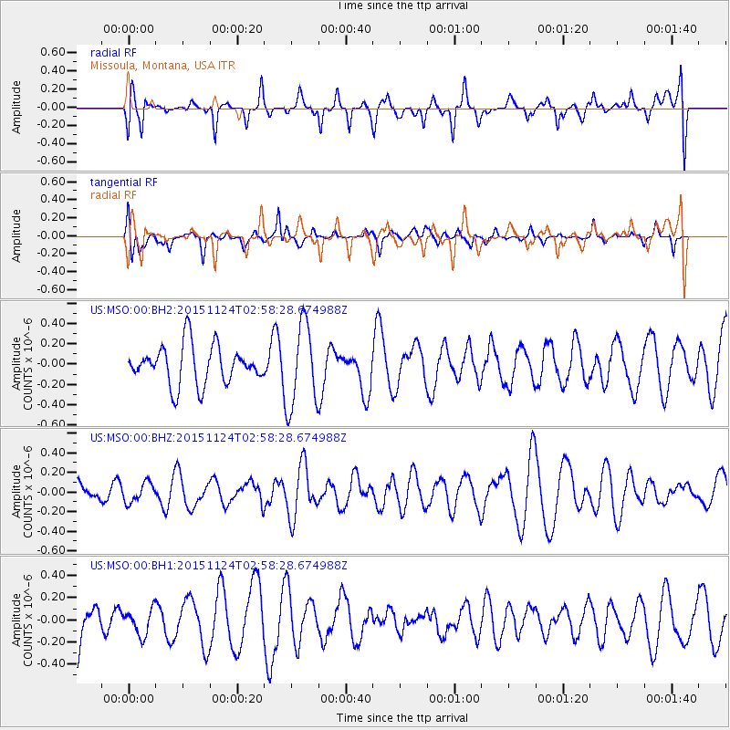
MSO Missoula, Montana, USA - Earthquake Result Viewer
*The percent match for this event was below the threshold and hence no stack was calculated.
| Earthquake location: |
South Of Tonga Islands |
| Earthquake latitude/longitude: |
-24.5/-173.8 |
| Earthquake time(UTC): |
2015/11/24 (328) 02:46:05 GMT |
| Earthquake Depth: |
15 km |
| Earthquake Magnitude: |
5.5 mwc |
| Earthquake Catalog/Contributor: |
NEIC PDE/ |
|
| Network: |
US United States National Seismic Network |
| Station: |
MSO Missoula, Montana, USA |
| Lat/Lon: |
46.83 N/113.94 W |
| Elevation: |
1264 m |
|
| Distance: |
89.2 deg |
| Az: |
36.447 deg |
| Baz: |
231.991 deg |
| Ray Param: |
$rayparam |
*The percent match for this event was below the threshold and hence was not used in the summary stack. |
|
| Radial Match: |
53.532627 % |
| Radial Bump: |
400 |
| Transverse Match: |
44.666027 % |
| Transverse Bump: |
320 |
| SOD ConfigId: |
7422571 |
| Insert Time: |
2019-04-21 10:55:18.863 +0000 |
| GWidth: |
2.5 |
| Max Bumps: |
400 |
| Tol: |
0.001 |
|
Signal To Noise
| Channel | StoN | STA | LTA |
| US:MSO:00:BHZ:20151124T02:58:28.674988Z | 0.82870907 | 1.00338525E-7 | 1.210781E-7 |
| US:MSO:00:BH1:20151124T02:58:28.674988Z | 0.3907917 | 1.1932312E-7 | 3.0533687E-7 |
| US:MSO:00:BH2:20151124T02:58:28.674988Z | 2.1575184 | 4.1161343E-7 | 1.9078095E-7 |
| Arrivals |
| Ps | |
| PpPs | |
| PsPs/PpSs | |


