You are here: Home > Network List > UW - Pacific Northwest Regional Seismic Network Stations List
> Station UMAT Pilot Rock, OR, USA > Earthquake Result Viewer
UMAT Pilot Rock, OR, USA - Earthquake Result Viewer
*The percent match for this event was below the threshold and hence no stack was calculated.
| Earthquake location: |
South Of Tonga Islands |
| Earthquake latitude/longitude: |
-24.5/-173.8 |
| Earthquake time(UTC): |
2015/11/24 (328) 02:46:05 GMT |
| Earthquake Depth: |
15 km |
| Earthquake Magnitude: |
5.5 mwc |
| Earthquake Catalog/Contributor: |
NEIC PDE/ |
|
| Network: |
UW Pacific Northwest Regional Seismic Network |
| Station: |
UMAT Pilot Rock, OR, USA |
| Lat/Lon: |
45.29 N/118.96 W |
| Elevation: |
1318 m |
|
| Distance: |
85.6 deg |
| Az: |
35.388 deg |
| Baz: |
228.339 deg |
| Ray Param: |
$rayparam |
*The percent match for this event was below the threshold and hence was not used in the summary stack. |
|
| Radial Match: |
70.88079 % |
| Radial Bump: |
400 |
| Transverse Match: |
42.420197 % |
| Transverse Bump: |
381 |
| SOD ConfigId: |
7422571 |
| Insert Time: |
2019-04-21 10:55:40.898 +0000 |
| GWidth: |
2.5 |
| Max Bumps: |
400 |
| Tol: |
0.001 |
|
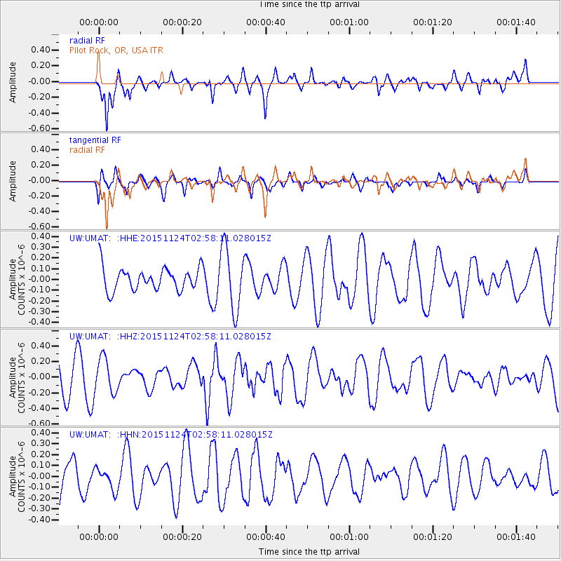
Signal To Noise
| Channel | StoN | STA | LTA |
| UW:UMAT: :HHZ:20151124T02:58:11.028015Z | 1.2977604 | 2.2176924E-7 | 1.7088612E-7 |
| UW:UMAT: :HHN:20151124T02:58:11.028015Z | 0.64451545 | 1.0440488E-7 | 1.6198973E-7 |
| UW:UMAT: :HHE:20151124T02:58:11.028015Z | 2.837455 | 2.9639008E-7 | 1.04456305E-7 |
| Arrivals |
| Ps | |
| PpPs | |
| PsPs/PpSs | |


