You are here: Home > Network List > IU - Global Seismograph Network (GSN - IRIS/USGS) Stations List
> Station PMG Port Moresby, New Guinea > Earthquake Result Viewer
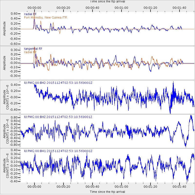
PMG Port Moresby, New Guinea - Earthquake Result Viewer
*The percent match for this event was below the threshold and hence no stack was calculated.
| Earthquake location: |
South Of Tonga Islands |
| Earthquake latitude/longitude: |
-24.8/-175.6 |
| Earthquake time(UTC): |
2015/11/24 (328) 02:46:18 GMT |
| Earthquake Depth: |
10 km |
| Earthquake Magnitude: |
5.4 mwb |
| Earthquake Catalog/Contributor: |
NEIC PDE/us |
|
| Network: |
IU Global Seismograph Network (GSN - IRIS/USGS) |
| Station: |
PMG Port Moresby, New Guinea |
| Lat/Lon: |
9.40 S/147.16 E |
| Elevation: |
90 m |
|
| Distance: |
38.6 deg |
| Az: |
286.719 deg |
| Baz: |
118.066 deg |
| Ray Param: |
$rayparam |
*The percent match for this event was below the threshold and hence was not used in the summary stack. |
|
| Radial Match: |
58.43322 % |
| Radial Bump: |
400 |
| Transverse Match: |
48.76969 % |
| Transverse Bump: |
400 |
| SOD ConfigId: |
7422571 |
| Insert Time: |
2019-04-21 10:59:49.261 +0000 |
| GWidth: |
2.5 |
| Max Bumps: |
400 |
| Tol: |
0.001 |
|
Signal To Noise
| Channel | StoN | STA | LTA |
| IU:PMG:00:BHZ:20151124T02:53:10.569001Z | 2.0458539 | 2.9305653E-7 | 1.4324411E-7 |
| IU:PMG:00:BH1:20151124T02:53:10.569001Z | 1.1669072 | 1.2563396E-7 | 1.0766406E-7 |
| IU:PMG:00:BH2:20151124T02:53:10.569001Z | 1.080006 | 1.3314282E-7 | 1.232797E-7 |
| Arrivals |
| Ps | |
| PpPs | |
| PsPs/PpSs | |


