You are here: Home > Network List > TA - USArray Transportable Network (new EarthScope stations) Stations List
> Station W39A Magazine, AR, USA > Earthquake Result Viewer
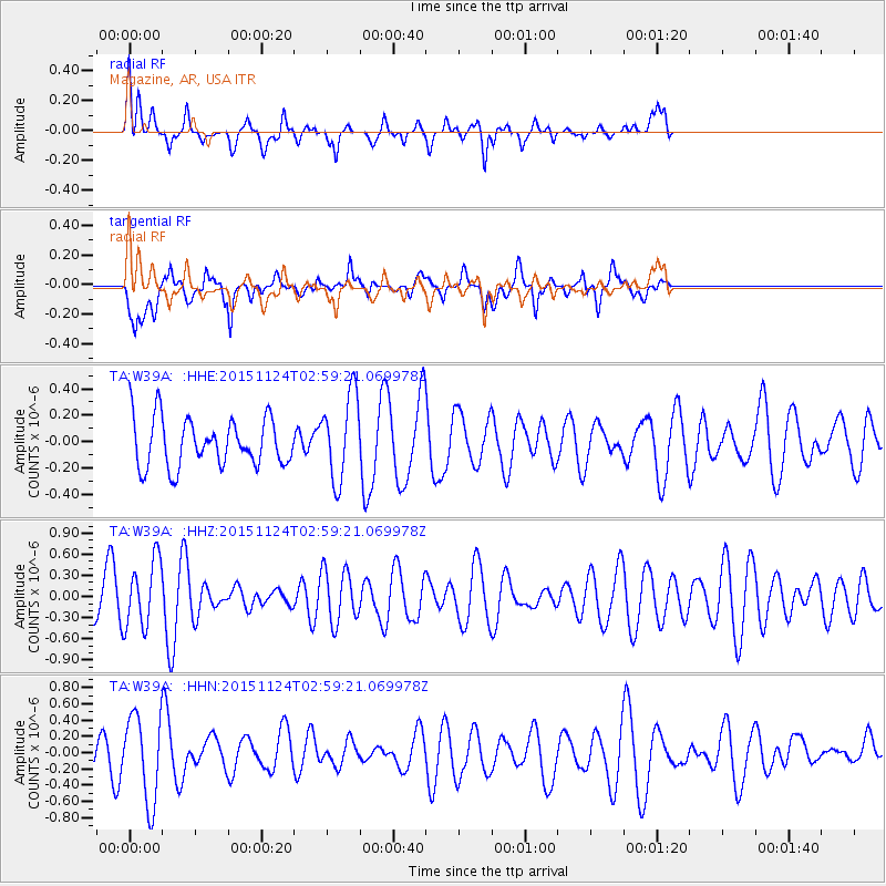
W39A Magazine, AR, USA - Earthquake Result Viewer
*The percent match for this event was below the threshold and hence no stack was calculated.
| Earthquake location: |
South Of Tonga Islands |
| Earthquake latitude/longitude: |
-24.8/-175.6 |
| Earthquake time(UTC): |
2015/11/24 (328) 02:46:18 GMT |
| Earthquake Depth: |
10 km |
| Earthquake Magnitude: |
5.4 mwb |
| Earthquake Catalog/Contributor: |
NEIC PDE/us |
|
| Network: |
TA USArray Transportable Network (new EarthScope stations) |
| Station: |
W39A Magazine, AR, USA |
| Lat/Lon: |
35.20 N/93.78 W |
| Elevation: |
162 m |
|
| Distance: |
97.6 deg |
| Az: |
54.868 deg |
| Baz: |
245.208 deg |
| Ray Param: |
$rayparam |
*The percent match for this event was below the threshold and hence was not used in the summary stack. |
|
| Radial Match: |
70.87467 % |
| Radial Bump: |
400 |
| Transverse Match: |
47.90737 % |
| Transverse Bump: |
400 |
| SOD ConfigId: |
7422571 |
| Insert Time: |
2019-04-21 11:02:07.444 +0000 |
| GWidth: |
2.5 |
| Max Bumps: |
400 |
| Tol: |
0.001 |
|
Signal To Noise
| Channel | StoN | STA | LTA |
| TA:W39A: :HHZ:20151124T02:59:21.069978Z | 1.560088 | 4.717858E-7 | 3.0240975E-7 |
| TA:W39A: :HHN:20151124T02:59:21.069978Z | 3.018351 | 5.2674136E-7 | 1.7451295E-7 |
| TA:W39A: :HHE:20151124T02:59:21.069978Z | 1.7919804 | 3.2705563E-7 | 1.8251072E-7 |
| Arrivals |
| Ps | |
| PpPs | |
| PsPs/PpSs | |


