You are here: Home > Network List > US - United States National Seismic Network Stations List
> Station EGMT Eagleton, Montana, USA > Earthquake Result Viewer
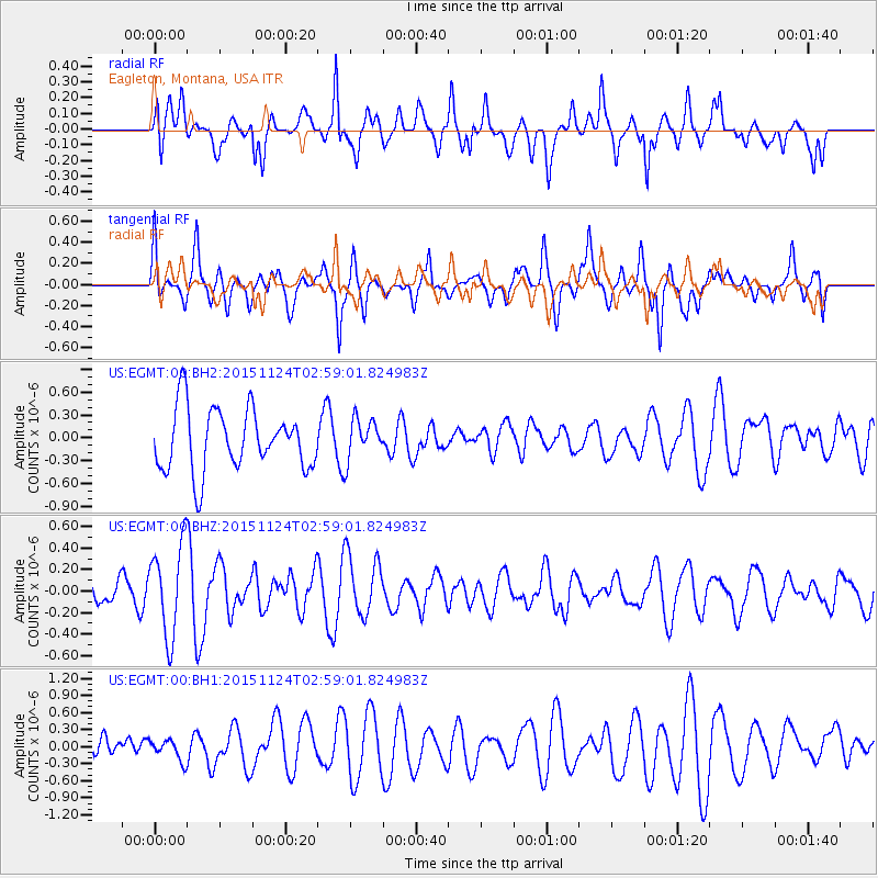
EGMT Eagleton, Montana, USA - Earthquake Result Viewer
*The percent match for this event was below the threshold and hence no stack was calculated.
| Earthquake location: |
South Of Tonga Islands |
| Earthquake latitude/longitude: |
-24.8/-175.6 |
| Earthquake time(UTC): |
2015/11/24 (328) 02:46:18 GMT |
| Earthquake Depth: |
10 km |
| Earthquake Magnitude: |
5.4 mwb |
| Earthquake Catalog/Contributor: |
NEIC PDE/us |
|
| Network: |
US United States National Seismic Network |
| Station: |
EGMT Eagleton, Montana, USA |
| Lat/Lon: |
48.02 N/109.75 W |
| Elevation: |
1055 m |
|
| Distance: |
93.4 deg |
| Az: |
37.839 deg |
| Baz: |
236.18 deg |
| Ray Param: |
$rayparam |
*The percent match for this event was below the threshold and hence was not used in the summary stack. |
|
| Radial Match: |
66.29538 % |
| Radial Bump: |
400 |
| Transverse Match: |
51.097282 % |
| Transverse Bump: |
400 |
| SOD ConfigId: |
7422571 |
| Insert Time: |
2019-04-21 11:02:21.412 +0000 |
| GWidth: |
2.5 |
| Max Bumps: |
400 |
| Tol: |
0.001 |
|
Signal To Noise
| Channel | StoN | STA | LTA |
| US:EGMT:00:BHZ:20151124T02:59:01.824983Z | 1.8270549 | 4.2423176E-7 | 2.3219431E-7 |
| US:EGMT:00:BH1:20151124T02:59:01.824983Z | 0.46392685 | 1.8499438E-7 | 3.987576E-7 |
| US:EGMT:00:BH2:20151124T02:59:01.824983Z | 0.661169 | 2.675968E-7 | 4.0473284E-7 |
| Arrivals |
| Ps | |
| PpPs | |
| PsPs/PpSs | |


