You are here: Home > Network List > AV - Alaska Volcano Observatory Stations List
> Station MAPS Pakushin Southeast, Makushin Volcano, Alaska > Earthquake Result Viewer
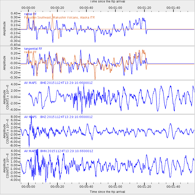
MAPS Pakushin Southeast, Makushin Volcano, Alaska - Earthquake Result Viewer
*The percent match for this event was below the threshold and hence no stack was calculated.
| Earthquake location: |
Mariana Islands |
| Earthquake latitude/longitude: |
18.8/145.3 |
| Earthquake time(UTC): |
2015/11/24 (328) 13:21:36 GMT |
| Earthquake Depth: |
586 km |
| Earthquake Magnitude: |
5.9 MWB |
| Earthquake Catalog/Contributor: |
NEIC PDE/NEIC COMCAT |
|
| Network: |
AV Alaska Volcano Observatory |
| Station: |
MAPS Pakushin Southeast, Makushin Volcano, Alaska |
| Lat/Lon: |
53.81 N/166.94 W |
| Elevation: |
333 m |
|
| Distance: |
50.6 deg |
| Az: |
34.65 deg |
| Baz: |
245.268 deg |
| Ray Param: |
$rayparam |
*The percent match for this event was below the threshold and hence was not used in the summary stack. |
|
| Radial Match: |
57.384407 % |
| Radial Bump: |
400 |
| Transverse Match: |
50.48172 % |
| Transverse Bump: |
400 |
| SOD ConfigId: |
7422571 |
| Insert Time: |
2019-04-21 11:06:25.386 +0000 |
| GWidth: |
2.5 |
| Max Bumps: |
400 |
| Tol: |
0.001 |
|
Signal To Noise
| Channel | StoN | STA | LTA |
| AV:MAPS: :BHZ:20151124T13:29:10.660001Z | 2.9685612 | 3.5630655E-6 | 1.2002669E-6 |
| AV:MAPS: :BHN:20151124T13:29:10.660001Z | 1.2769054 | 1.7450382E-6 | 1.366615E-6 |
| AV:MAPS: :BHE:20151124T13:29:10.660001Z | 1.0446417 | 1.6174604E-6 | 1.5483397E-6 |
| Arrivals |
| Ps | |
| PpPs | |
| PsPs/PpSs | |


