You are here: Home > Network List > CI - Caltech Regional Seismic Network Stations List
> Station MPM Manuel Prospect Mine, California, USA > Earthquake Result Viewer
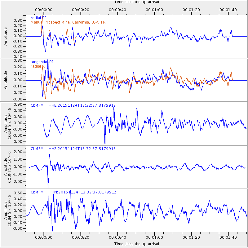
MPM Manuel Prospect Mine, California, USA - Earthquake Result Viewer
*The percent match for this event was below the threshold and hence no stack was calculated.
| Earthquake location: |
Mariana Islands |
| Earthquake latitude/longitude: |
18.8/145.3 |
| Earthquake time(UTC): |
2015/11/24 (328) 13:21:36 GMT |
| Earthquake Depth: |
586 km |
| Earthquake Magnitude: |
5.9 MWB |
| Earthquake Catalog/Contributor: |
NEIC PDE/NEIC COMCAT |
|
| Network: |
CI Caltech Regional Seismic Network |
| Station: |
MPM Manuel Prospect Mine, California, USA |
| Lat/Lon: |
36.06 N/117.49 W |
| Elevation: |
185 m |
|
| Distance: |
84.8 deg |
| Az: |
53.829 deg |
| Baz: |
289.287 deg |
| Ray Param: |
$rayparam |
*The percent match for this event was below the threshold and hence was not used in the summary stack. |
|
| Radial Match: |
45.06671 % |
| Radial Bump: |
400 |
| Transverse Match: |
51.22999 % |
| Transverse Bump: |
400 |
| SOD ConfigId: |
7422571 |
| Insert Time: |
2019-04-21 11:07:40.632 +0000 |
| GWidth: |
2.5 |
| Max Bumps: |
400 |
| Tol: |
0.001 |
|
Signal To Noise
| Channel | StoN | STA | LTA |
| CI:MPM: :HHZ:20151124T13:32:37.817991Z | 8.605615 | 8.0852476E-7 | 9.395316E-8 |
| CI:MPM: :HHN:20151124T13:32:37.817991Z | 1.7866026 | 2.644175E-7 | 1.4800018E-7 |
| CI:MPM: :HHE:20151124T13:32:37.817991Z | 1.1650684 | 3.3001456E-7 | 2.8325766E-7 |
| Arrivals |
| Ps | |
| PpPs | |
| PsPs/PpSs | |


