You are here: Home > Network List > UU - University of Utah Regional Network Stations List
> Station WPUT Wasatch Plateau, UT,USA > Earthquake Result Viewer
WPUT Wasatch Plateau, UT,USA - Earthquake Result Viewer

| Earthquake location: |
Samoa Islands Region |
| Earthquake latitude/longitude: |
-15.6/-173.0 |
| Earthquake time(UTC): |
2015/06/12 (163) 11:07:04 GMT |
| Earthquake Depth: |
29 km |
| Earthquake Magnitude: |
6.3 MO |
| Earthquake Catalog/Contributor: |
NEIC PDE/NEIC ALERT |
|
| Network: |
UU University of Utah Regional Network |
| Station: |
WPUT Wasatch Plateau, UT,USA |
| Lat/Lon: |
39.00 N/111.36 W |
| Elevation: |
2618 m |
|
| Distance: |
79.1 deg |
| Az: |
44.292 deg |
| Baz: |
239.722 deg |
| Ray Param: |
0.049163133 |
| Estimated Moho Depth: |
23.5 km |
| Estimated Crust Vp/Vs: |
1.73 |
| Assumed Crust Vp: |
6.207 km/s |
| Estimated Crust Vs: |
3.598 km/s |
| Estimated Crust Poisson's Ratio: |
0.25 |
|
| Radial Match: |
88.93226 % |
| Radial Bump: |
400 |
| Transverse Match: |
89.971306 % |
| Transverse Bump: |
400 |
| SOD ConfigId: |
976571 |
| Insert Time: |
2015-06-26 12:39:16.700 +0000 |
| GWidth: |
2.5 |
| Max Bumps: |
400 |
| Tol: |
0.001 |
|
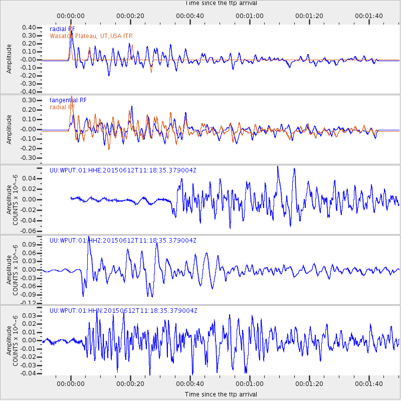
Signal To Noise
| Channel | StoN | STA | LTA |
| UU:WPUT:01:HHZ:20150612T11:18:35.379004Z | 11.8428335 | 2.8028072E-8 | 2.3666695E-9 |
| UU:WPUT:01:HHN:20150612T11:18:35.379004Z | 1.3239201 | 3.205767E-9 | 2.4214202E-9 |
| UU:WPUT:01:HHE:20150612T11:18:35.379004Z | 3.0186472 | 8.513879E-9 | 2.8204286E-9 |
| Arrivals |
| Ps | 2.8 SECOND |
| PpPs | 10 SECOND |
| PsPs/PpSs | 13 SECOND |


