You are here: Home > Network List > TA - USArray Transportable Network (new EarthScope stations) Stations List
> Station J26L Joseph Creek, AK, USA > Earthquake Result Viewer
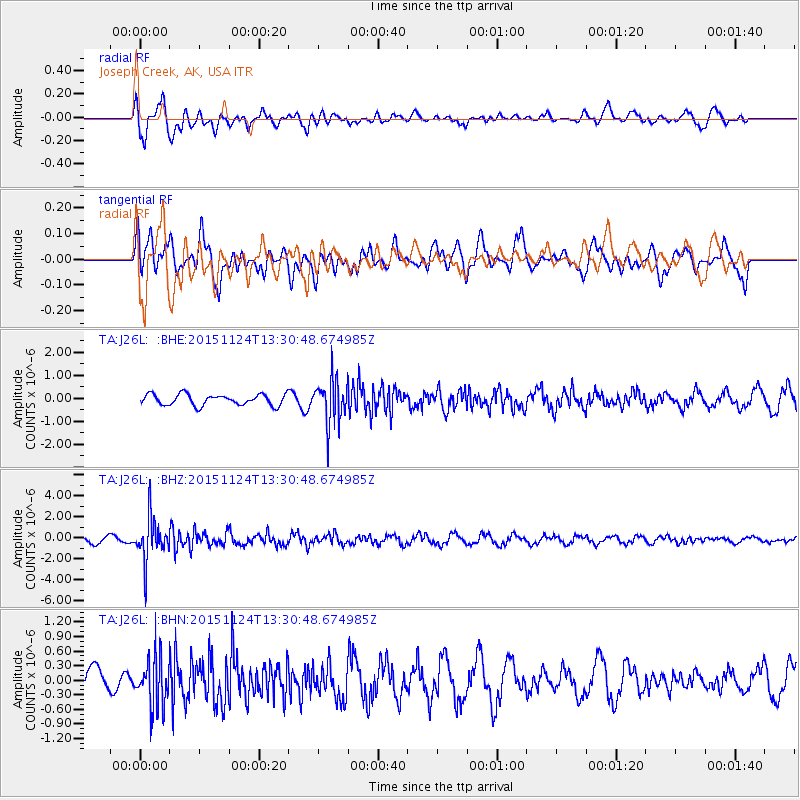
J26L Joseph Creek, AK, USA - Earthquake Result Viewer
*The percent match for this event was below the threshold and hence no stack was calculated.
| Earthquake location: |
Mariana Islands |
| Earthquake latitude/longitude: |
18.8/145.3 |
| Earthquake time(UTC): |
2015/11/24 (328) 13:21:36 GMT |
| Earthquake Depth: |
586 km |
| Earthquake Magnitude: |
5.9 MWB |
| Earthquake Catalog/Contributor: |
NEIC PDE/NEIC COMCAT |
|
| Network: |
TA USArray Transportable Network (new EarthScope stations) |
| Station: |
J26L Joseph Creek, AK, USA |
| Lat/Lon: |
64.50 N/143.56 W |
| Elevation: |
1144 m |
|
| Distance: |
65.1 deg |
| Az: |
26.845 deg |
| Baz: |
261.269 deg |
| Ray Param: |
$rayparam |
*The percent match for this event was below the threshold and hence was not used in the summary stack. |
|
| Radial Match: |
77.11383 % |
| Radial Bump: |
400 |
| Transverse Match: |
47.582767 % |
| Transverse Bump: |
400 |
| SOD ConfigId: |
7422571 |
| Insert Time: |
2019-04-21 11:11:39.209 +0000 |
| GWidth: |
2.5 |
| Max Bumps: |
400 |
| Tol: |
0.001 |
|
Signal To Noise
| Channel | StoN | STA | LTA |
| TA:J26L: :BHZ:20151124T13:30:48.674985Z | 7.9278903 | 2.0523353E-6 | 2.5887533E-7 |
| TA:J26L: :BHN:20151124T13:30:48.674985Z | 1.5163463 | 5.3926914E-7 | 3.5563718E-7 |
| TA:J26L: :BHE:20151124T13:30:48.674985Z | 4.028019 | 1.0032123E-6 | 2.490585E-7 |
| Arrivals |
| Ps | |
| PpPs | |
| PsPs/PpSs | |


