You are here: Home > Network List > TA - USArray Transportable Network (new EarthScope stations) Stations List
> Station L04D Klamath Falls, OR, USA > Earthquake Result Viewer
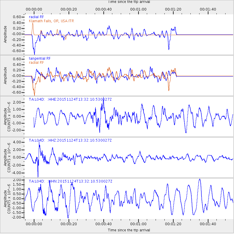
L04D Klamath Falls, OR, USA - Earthquake Result Viewer
*The percent match for this event was below the threshold and hence no stack was calculated.
| Earthquake location: |
Mariana Islands |
| Earthquake latitude/longitude: |
18.8/145.3 |
| Earthquake time(UTC): |
2015/11/24 (328) 13:21:36 GMT |
| Earthquake Depth: |
586 km |
| Earthquake Magnitude: |
5.9 MWB |
| Earthquake Catalog/Contributor: |
NEIC PDE/NEIC COMCAT |
|
| Network: |
TA USArray Transportable Network (new EarthScope stations) |
| Station: |
L04D Klamath Falls, OR, USA |
| Lat/Lon: |
42.22 N/122.30 W |
| Elevation: |
1437 m |
|
| Distance: |
79.3 deg |
| Az: |
49.043 deg |
| Baz: |
285.592 deg |
| Ray Param: |
$rayparam |
*The percent match for this event was below the threshold and hence was not used in the summary stack. |
|
| Radial Match: |
69.278145 % |
| Radial Bump: |
400 |
| Transverse Match: |
50.379604 % |
| Transverse Bump: |
368 |
| SOD ConfigId: |
7422571 |
| Insert Time: |
2019-04-21 11:11:43.981 +0000 |
| GWidth: |
2.5 |
| Max Bumps: |
400 |
| Tol: |
0.001 |
|
Signal To Noise
| Channel | StoN | STA | LTA |
| TA:L04D: :HHZ:20151124T13:32:10.530027Z | 7.849787 | 1.8148743E-6 | 2.3120045E-7 |
| TA:L04D: :HHN:20151124T13:32:10.530027Z | 1.1248361 | 8.501664E-7 | 7.558136E-7 |
| TA:L04D: :HHE:20151124T13:32:10.530027Z | 0.80245113 | 5.1448234E-7 | 6.4113857E-7 |
| Arrivals |
| Ps | |
| PpPs | |
| PsPs/PpSs | |


