You are here: Home > Network List > TA - USArray Transportable Network (new EarthScope stations) Stations List
> Station MDND Maddock, ND, USA > Earthquake Result Viewer
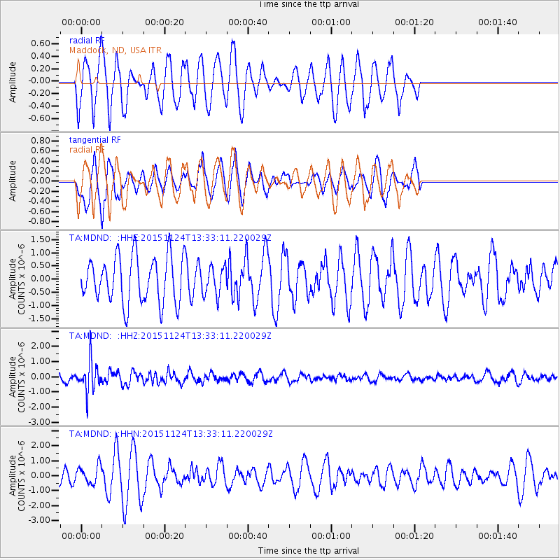
MDND Maddock, ND, USA - Earthquake Result Viewer
*The percent match for this event was below the threshold and hence no stack was calculated.
| Earthquake location: |
Mariana Islands |
| Earthquake latitude/longitude: |
18.8/145.3 |
| Earthquake time(UTC): |
2015/11/24 (328) 13:21:36 GMT |
| Earthquake Depth: |
586 km |
| Earthquake Magnitude: |
5.9 MWB |
| Earthquake Catalog/Contributor: |
NEIC PDE/NEIC COMCAT |
|
| Network: |
TA USArray Transportable Network (new EarthScope stations) |
| Station: |
MDND Maddock, ND, USA |
| Lat/Lon: |
47.85 N/99.60 W |
| Elevation: |
479 m |
|
| Distance: |
92.0 deg |
| Az: |
37.615 deg |
| Baz: |
300.851 deg |
| Ray Param: |
$rayparam |
*The percent match for this event was below the threshold and hence was not used in the summary stack. |
|
| Radial Match: |
62.350605 % |
| Radial Bump: |
370 |
| Transverse Match: |
71.1328 % |
| Transverse Bump: |
372 |
| SOD ConfigId: |
7422571 |
| Insert Time: |
2019-04-21 11:11:52.222 +0000 |
| GWidth: |
2.5 |
| Max Bumps: |
400 |
| Tol: |
0.001 |
|
Signal To Noise
| Channel | StoN | STA | LTA |
| TA:MDND: :HHZ:20151124T13:33:11.220029Z | 3.7460182 | 1.0621369E-6 | 2.835376E-7 |
| TA:MDND: :HHN:20151124T13:33:11.220029Z | 0.95506793 | 6.276585E-7 | 6.571873E-7 |
| TA:MDND: :HHE:20151124T13:33:11.220029Z | 0.60393804 | 5.389928E-7 | 8.924638E-7 |
| Arrivals |
| Ps | |
| PpPs | |
| PsPs/PpSs | |


