You are here: Home > Network List > TA - USArray Transportable Network (new EarthScope stations) Stations List
> Station R11A Troy Canyon, Currant, NV, USA > Earthquake Result Viewer
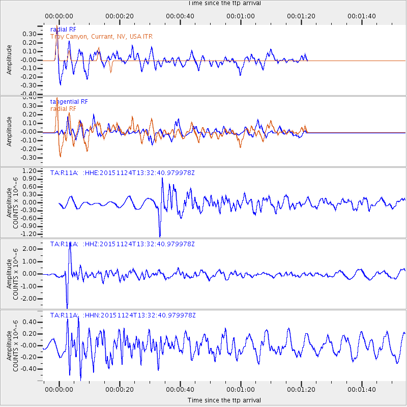
R11A Troy Canyon, Currant, NV, USA - Earthquake Result Viewer
*The percent match for this event was below the threshold and hence no stack was calculated.
| Earthquake location: |
Mariana Islands |
| Earthquake latitude/longitude: |
18.8/145.3 |
| Earthquake time(UTC): |
2015/11/24 (328) 13:21:36 GMT |
| Earthquake Depth: |
586 km |
| Earthquake Magnitude: |
5.9 MWB |
| Earthquake Catalog/Contributor: |
NEIC PDE/NEIC COMCAT |
|
| Network: |
TA USArray Transportable Network (new EarthScope stations) |
| Station: |
R11A Troy Canyon, Currant, NV, USA |
| Lat/Lon: |
38.35 N/115.59 W |
| Elevation: |
1756 m |
|
| Distance: |
85.4 deg |
| Az: |
51.153 deg |
| Baz: |
290.205 deg |
| Ray Param: |
$rayparam |
*The percent match for this event was below the threshold and hence was not used in the summary stack. |
|
| Radial Match: |
62.35381 % |
| Radial Bump: |
374 |
| Transverse Match: |
53.820812 % |
| Transverse Bump: |
331 |
| SOD ConfigId: |
7422571 |
| Insert Time: |
2019-04-21 11:12:04.630 +0000 |
| GWidth: |
2.5 |
| Max Bumps: |
400 |
| Tol: |
0.001 |
|
Signal To Noise
| Channel | StoN | STA | LTA |
| TA:R11A: :HHZ:20151124T13:32:40.979978Z | 9.636665 | 1.0826056E-6 | 1.1234235E-7 |
| TA:R11A: :HHN:20151124T13:32:40.979978Z | 1.6678861 | 2.1133748E-7 | 1.2670978E-7 |
| TA:R11A: :HHE:20151124T13:32:40.979978Z | 3.8291395 | 4.5841398E-7 | 1.1971724E-7 |
| Arrivals |
| Ps | |
| PpPs | |
| PsPs/PpSs | |


