You are here: Home > Network List > TA - USArray Transportable Network (new EarthScope stations) Stations List
> Station T25A Trinidad, CO, USA > Earthquake Result Viewer
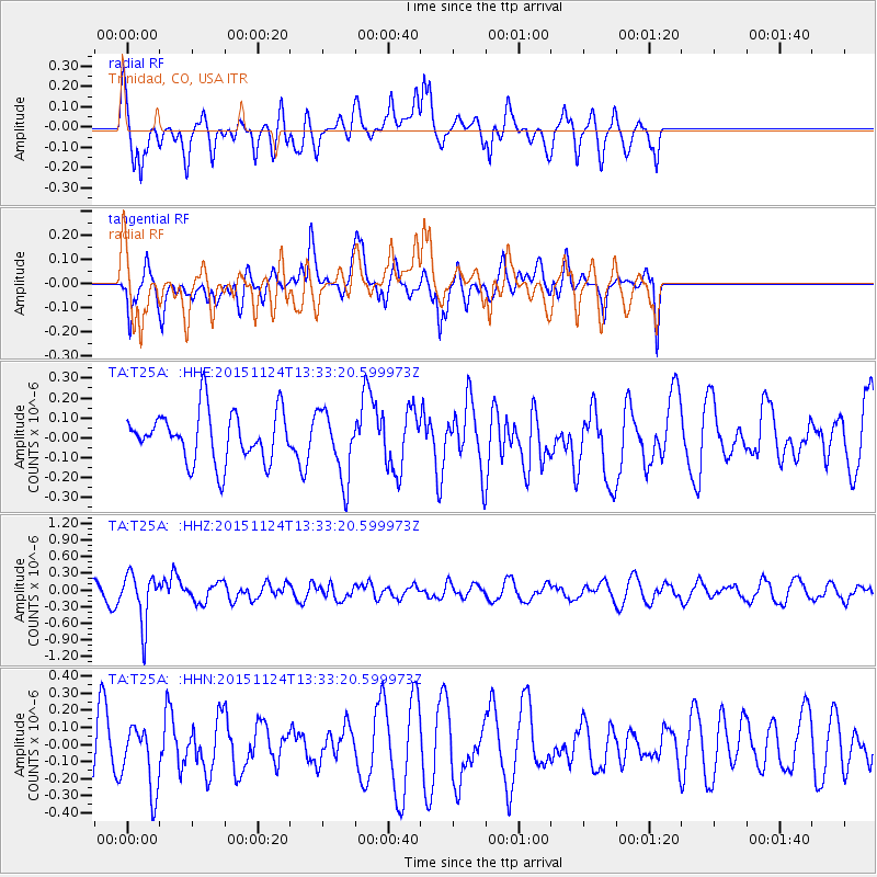
T25A Trinidad, CO, USA - Earthquake Result Viewer
*The percent match for this event was below the threshold and hence no stack was calculated.
| Earthquake location: |
Mariana Islands |
| Earthquake latitude/longitude: |
18.8/145.3 |
| Earthquake time(UTC): |
2015/11/24 (328) 13:21:36 GMT |
| Earthquake Depth: |
586 km |
| Earthquake Magnitude: |
5.9 MWB |
| Earthquake Catalog/Contributor: |
NEIC PDE/NEIC COMCAT |
|
| Network: |
TA USArray Transportable Network (new EarthScope stations) |
| Station: |
T25A Trinidad, CO, USA |
| Lat/Lon: |
37.14 N/104.41 W |
| Elevation: |
2017 m |
|
| Distance: |
94.0 deg |
| Az: |
48.712 deg |
| Baz: |
297.018 deg |
| Ray Param: |
$rayparam |
*The percent match for this event was below the threshold and hence was not used in the summary stack. |
|
| Radial Match: |
48.437454 % |
| Radial Bump: |
384 |
| Transverse Match: |
47.423286 % |
| Transverse Bump: |
355 |
| SOD ConfigId: |
7422571 |
| Insert Time: |
2019-04-21 11:12:05.140 +0000 |
| GWidth: |
2.5 |
| Max Bumps: |
400 |
| Tol: |
0.001 |
|
Signal To Noise
| Channel | StoN | STA | LTA |
| TA:T25A: :HHZ:20151124T13:33:20.599973Z | 3.751819 | 4.4406568E-7 | 1.18360106E-7 |
| TA:T25A: :HHN:20151124T13:33:20.599973Z | 0.7345219 | 1.9015594E-7 | 2.5888397E-7 |
| TA:T25A: :HHE:20151124T13:33:20.599973Z | 1.3033866 | 1.6295215E-7 | 1.2502211E-7 |
| Arrivals |
| Ps | |
| PpPs | |
| PsPs/PpSs | |


