You are here: Home > Network List > TA - USArray Transportable Network (new EarthScope stations) Stations List
> Station TPFO Pinon Flats, CA, USA > Earthquake Result Viewer
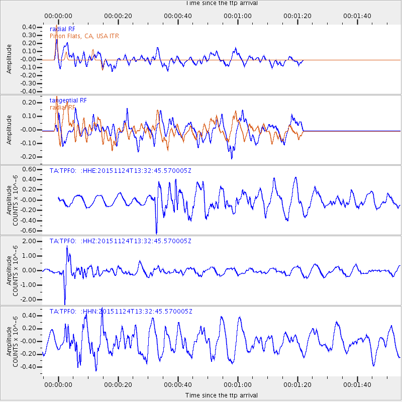
TPFO Pinon Flats, CA, USA - Earthquake Result Viewer
*The percent match for this event was below the threshold and hence no stack was calculated.
| Earthquake location: |
Mariana Islands |
| Earthquake latitude/longitude: |
18.8/145.3 |
| Earthquake time(UTC): |
2015/11/24 (328) 13:21:36 GMT |
| Earthquake Depth: |
586 km |
| Earthquake Magnitude: |
5.9 MWB |
| Earthquake Catalog/Contributor: |
NEIC PDE/NEIC COMCAT |
|
| Network: |
TA USArray Transportable Network (new EarthScope stations) |
| Station: |
TPFO Pinon Flats, CA, USA |
| Lat/Lon: |
33.61 N/116.45 W |
| Elevation: |
1275 m |
|
| Distance: |
86.4 deg |
| Az: |
55.852 deg |
| Baz: |
290.031 deg |
| Ray Param: |
$rayparam |
*The percent match for this event was below the threshold and hence was not used in the summary stack. |
|
| Radial Match: |
55.667828 % |
| Radial Bump: |
400 |
| Transverse Match: |
65.41309 % |
| Transverse Bump: |
400 |
| SOD ConfigId: |
7422571 |
| Insert Time: |
2019-04-21 11:12:06.628 +0000 |
| GWidth: |
2.5 |
| Max Bumps: |
400 |
| Tol: |
0.001 |
|
Signal To Noise
| Channel | StoN | STA | LTA |
| TA:TPFO: :HHZ:20151124T13:32:45.570005Z | 4.6854773 | 8.348365E-7 | 1.7817536E-7 |
| TA:TPFO: :HHN:20151124T13:32:45.570005Z | 0.7510555 | 1.098045E-7 | 1.4620026E-7 |
| TA:TPFO: :HHE:20151124T13:32:45.570005Z | 2.798476 | 2.3560445E-7 | 8.419027E-8 |
| Arrivals |
| Ps | |
| PpPs | |
| PsPs/PpSs | |


