You are here: Home > Network List > UW - Pacific Northwest Regional Seismic Network Stations List
> Station MRBL Marblemount, WA, USA > Earthquake Result Viewer
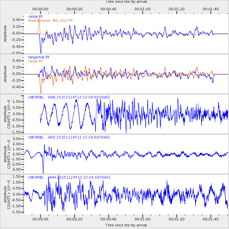
MRBL Marblemount, WA, USA - Earthquake Result Viewer
*The percent match for this event was below the threshold and hence no stack was calculated.
| Earthquake location: |
Mariana Islands |
| Earthquake latitude/longitude: |
18.8/145.3 |
| Earthquake time(UTC): |
2015/11/24 (328) 13:21:36 GMT |
| Earthquake Depth: |
586 km |
| Earthquake Magnitude: |
5.9 MWB |
| Earthquake Catalog/Contributor: |
NEIC PDE/NEIC COMCAT |
|
| Network: |
UW Pacific Northwest Regional Seismic Network |
| Station: |
MRBL Marblemount, WA, USA |
| Lat/Lon: |
48.52 N/121.48 W |
| Elevation: |
75 m |
|
| Distance: |
78.2 deg |
| Az: |
42.691 deg |
| Baz: |
284.939 deg |
| Ray Param: |
$rayparam |
*The percent match for this event was below the threshold and hence was not used in the summary stack. |
|
| Radial Match: |
51.360336 % |
| Radial Bump: |
400 |
| Transverse Match: |
60.85961 % |
| Transverse Bump: |
400 |
| SOD ConfigId: |
7422571 |
| Insert Time: |
2019-04-21 11:12:43.826 +0000 |
| GWidth: |
2.5 |
| Max Bumps: |
400 |
| Tol: |
0.001 |
|
Signal To Noise
| Channel | StoN | STA | LTA |
| UW:MRBL: :HHZ:20151124T13:32:04.697996Z | 2.4268465 | 1.0447181E-6 | 4.3048382E-7 |
| UW:MRBL: :HHN:20151124T13:32:04.697996Z | 1.8706034 | 5.036246E-7 | 2.692311E-7 |
| UW:MRBL: :HHE:20151124T13:32:04.697996Z | 1.112021 | 7.3921825E-7 | 6.647521E-7 |
| Arrivals |
| Ps | |
| PpPs | |
| PsPs/PpSs | |


