You are here: Home > Network List > UW - Pacific Northwest Regional Seismic Network Stations List
> Station UMAT Pilot Rock, OR, USA > Earthquake Result Viewer
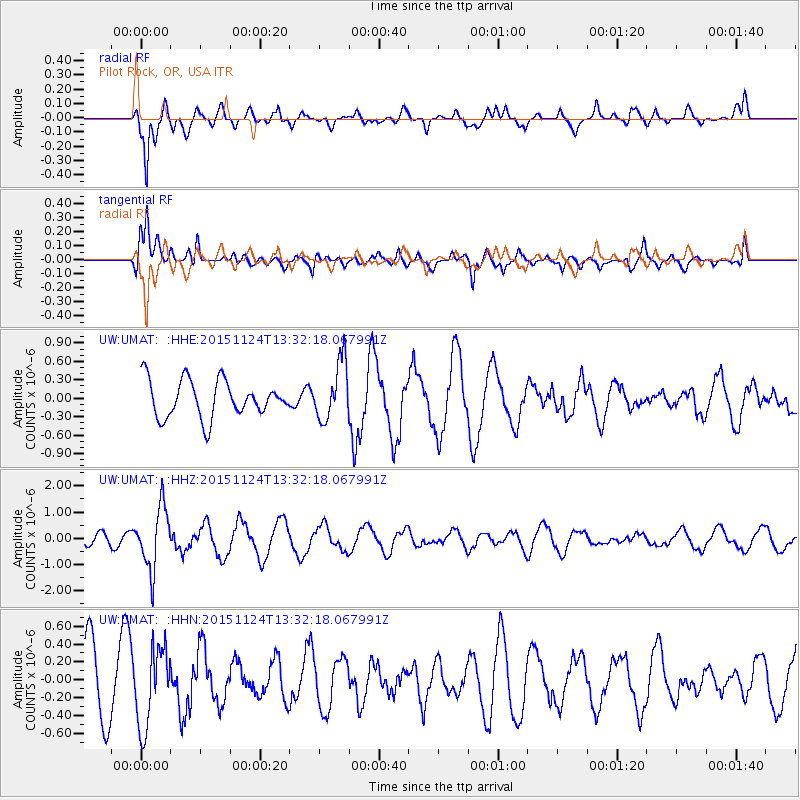
UMAT Pilot Rock, OR, USA - Earthquake Result Viewer
*The percent match for this event was below the threshold and hence no stack was calculated.
| Earthquake location: |
Mariana Islands |
| Earthquake latitude/longitude: |
18.8/145.3 |
| Earthquake time(UTC): |
2015/11/24 (328) 13:21:36 GMT |
| Earthquake Depth: |
586 km |
| Earthquake Magnitude: |
5.9 MWB |
| Earthquake Catalog/Contributor: |
NEIC PDE/NEIC COMCAT |
|
| Network: |
UW Pacific Northwest Regional Seismic Network |
| Station: |
UMAT Pilot Rock, OR, USA |
| Lat/Lon: |
45.29 N/118.96 W |
| Elevation: |
1318 m |
|
| Distance: |
80.8 deg |
| Az: |
45.357 deg |
| Baz: |
287.263 deg |
| Ray Param: |
$rayparam |
*The percent match for this event was below the threshold and hence was not used in the summary stack. |
|
| Radial Match: |
85.52124 % |
| Radial Bump: |
371 |
| Transverse Match: |
61.790188 % |
| Transverse Bump: |
374 |
| SOD ConfigId: |
7422571 |
| Insert Time: |
2019-04-21 11:12:49.141 +0000 |
| GWidth: |
2.5 |
| Max Bumps: |
400 |
| Tol: |
0.001 |
|
Signal To Noise
| Channel | StoN | STA | LTA |
| UW:UMAT: :HHZ:20151124T13:32:18.067991Z | 3.269679 | 1.1697447E-6 | 3.5775517E-7 |
| UW:UMAT: :HHN:20151124T13:32:18.067991Z | 1.5512595 | 4.4293753E-7 | 2.8553413E-7 |
| UW:UMAT: :HHE:20151124T13:32:18.067991Z | 1.709211 | 4.935872E-7 | 2.8878074E-7 |
| Arrivals |
| Ps | |
| PpPs | |
| PsPs/PpSs | |


