You are here: Home > Network List > TA - USArray Transportable Network (new EarthScope stations) Stations List
> Station POKR Poker Plat Research Range, AK, USA > Earthquake Result Viewer
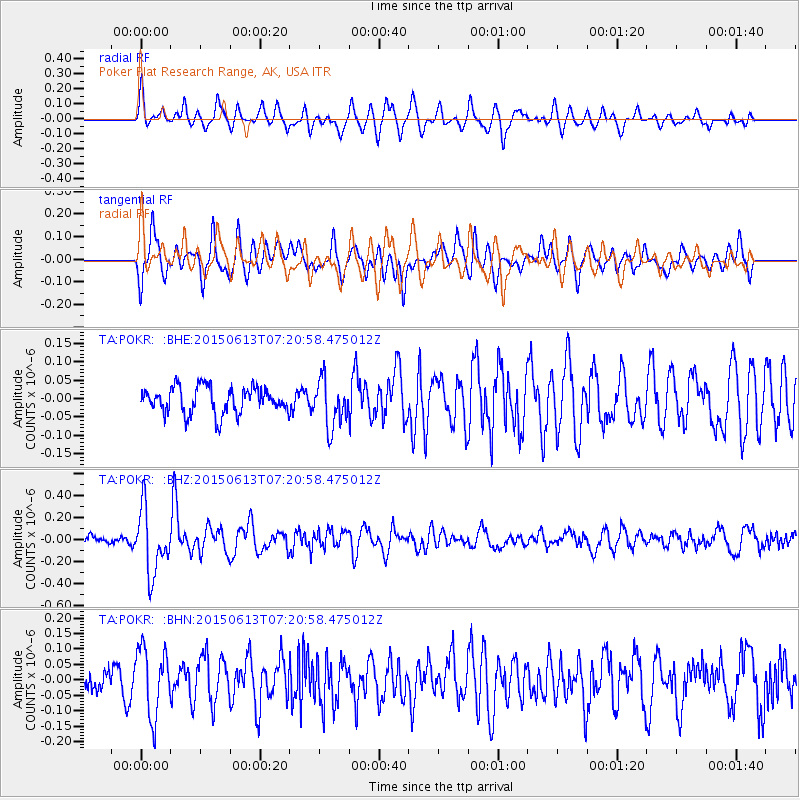
POKR Poker Plat Research Range, AK, USA - Earthquake Result Viewer
*The percent match for this event was below the threshold and hence no stack was calculated.
| Earthquake location: |
Near N Coast Of New Guinea, P.N.G. |
| Earthquake latitude/longitude: |
-3.2/143.8 |
| Earthquake time(UTC): |
2015/06/13 (164) 07:08:58 GMT |
| Earthquake Depth: |
10 km |
| Earthquake Magnitude: |
5.6 MB |
| Earthquake Catalog/Contributor: |
NEIC PDE/NEIC ALERT |
|
| Network: |
TA USArray Transportable Network (new EarthScope stations) |
| Station: |
POKR Poker Plat Research Range, AK, USA |
| Lat/Lon: |
65.12 N/147.43 W |
| Elevation: |
501 m |
|
| Distance: |
84.1 deg |
| Az: |
23.349 deg |
| Baz: |
249.272 deg |
| Ray Param: |
$rayparam |
*The percent match for this event was below the threshold and hence was not used in the summary stack. |
|
| Radial Match: |
74.581764 % |
| Radial Bump: |
400 |
| Transverse Match: |
62.44747 % |
| Transverse Bump: |
400 |
| SOD ConfigId: |
976571 |
| Insert Time: |
2015-06-27 07:31:37.423 +0000 |
| GWidth: |
2.5 |
| Max Bumps: |
400 |
| Tol: |
0.001 |
|
Signal To Noise
| Channel | StoN | STA | LTA |
| TA:POKR: :BHZ:20150613T07:20:58.475012Z | 7.6345563 | 2.9319057E-7 | 3.8403094E-8 |
| TA:POKR: :BHN:20150613T07:20:58.475012Z | 2.9439192 | 1.1022627E-7 | 3.7442014E-8 |
| TA:POKR: :BHE:20150613T07:20:58.475012Z | 1.7806243 | 6.403037E-8 | 3.5959506E-8 |
| Arrivals |
| Ps | |
| PpPs | |
| PsPs/PpSs | |


