You are here: Home > Network List > US - United States National Seismic Network Stations List
> Station EGMT Eagleton, Montana, USA > Earthquake Result Viewer
EGMT Eagleton, Montana, USA - Earthquake Result Viewer
*The percent match for this event was below the threshold and hence no stack was calculated.
| Earthquake location: |
North Of Ascension Island |
| Earthquake latitude/longitude: |
-0.1/-17.8 |
| Earthquake time(UTC): |
2015/11/24 (328) 20:45:02 GMT |
| Earthquake Depth: |
10 km |
| Earthquake Magnitude: |
5.5 mwb |
| Earthquake Catalog/Contributor: |
NEIC PDE/us |
|
| Network: |
US United States National Seismic Network |
| Station: |
EGMT Eagleton, Montana, USA |
| Lat/Lon: |
48.02 N/109.75 W |
| Elevation: |
1055 m |
|
| Distance: |
91.4 deg |
| Az: |
317.847 deg |
| Baz: |
88.642 deg |
| Ray Param: |
$rayparam |
*The percent match for this event was below the threshold and hence was not used in the summary stack. |
|
| Radial Match: |
49.954456 % |
| Radial Bump: |
400 |
| Transverse Match: |
57.024742 % |
| Transverse Bump: |
400 |
| SOD ConfigId: |
7422571 |
| Insert Time: |
2019-04-21 11:21:04.145 +0000 |
| GWidth: |
2.5 |
| Max Bumps: |
400 |
| Tol: |
0.001 |
|
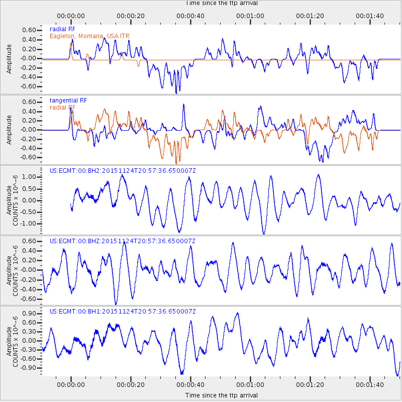
Signal To Noise
| Channel | StoN | STA | LTA |
| US:EGMT:00:BHZ:20151124T20:57:36.650007Z | 0.6879526 | 2.7662225E-7 | 4.020949E-7 |
| US:EGMT:00:BH1:20151124T20:57:36.650007Z | 0.6124305 | 1.9906099E-7 | 3.250344E-7 |
| US:EGMT:00:BH2:20151124T20:57:36.650007Z | 2.1273904 | 7.876779E-7 | 3.7025546E-7 |
| Arrivals |
| Ps | |
| PpPs | |
| PsPs/PpSs | |


