You are here: Home > Network List > US - United States National Seismic Network Stations List
> Station EGMT Eagleton, Montana, USA > Earthquake Result Viewer
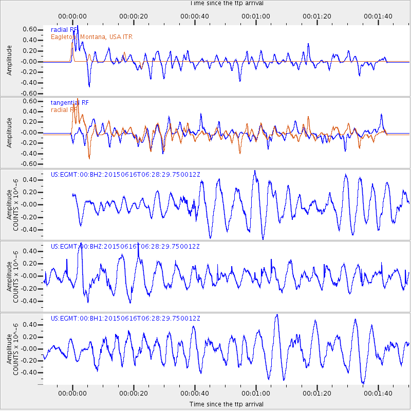
EGMT Eagleton, Montana, USA - Earthquake Result Viewer
*The percent match for this event was below the threshold and hence no stack was calculated.
| Earthquake location: |
Fiji Islands Region |
| Earthquake latitude/longitude: |
-20.4/-178.9 |
| Earthquake time(UTC): |
2015/06/16 (167) 06:16:59 GMT |
| Earthquake Depth: |
646 km |
| Earthquake Magnitude: |
5.9 MO |
| Earthquake Catalog/Contributor: |
NEIC PDE/NEIC ALERT |
|
| Network: |
US United States National Seismic Network |
| Station: |
EGMT Eagleton, Montana, USA |
| Lat/Lon: |
48.02 N/109.75 W |
| Elevation: |
1055 m |
|
| Distance: |
91.9 deg |
| Az: |
38.886 deg |
| Baz: |
241.307 deg |
| Ray Param: |
$rayparam |
*The percent match for this event was below the threshold and hence was not used in the summary stack. |
|
| Radial Match: |
70.130104 % |
| Radial Bump: |
400 |
| Transverse Match: |
56.80586 % |
| Transverse Bump: |
400 |
| SOD ConfigId: |
976571 |
| Insert Time: |
2015-06-30 06:46:24.640 +0000 |
| GWidth: |
2.5 |
| Max Bumps: |
400 |
| Tol: |
0.001 |
|
Signal To Noise
| Channel | StoN | STA | LTA |
| US:EGMT:00:BHZ:20150616T06:28:29.750012Z | 3.5689754 | 2.765535E-7 | 7.748821E-8 |
| US:EGMT:00:BH1:20150616T06:28:29.750012Z | 1.0963075 | 1.1967553E-7 | 1.0916237E-7 |
| US:EGMT:00:BH2:20150616T06:28:29.750012Z | 1.2642912 | 1.1963347E-7 | 9.462493E-8 |
| Arrivals |
| Ps | |
| PpPs | |
| PsPs/PpSs | |


