You are here: Home > Network List > US - United States National Seismic Network Stations List
> Station HAWA Hanford, Washington, USA > Earthquake Result Viewer
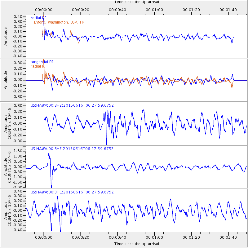
HAWA Hanford, Washington, USA - Earthquake Result Viewer
*The percent match for this event was below the threshold and hence no stack was calculated.
| Earthquake location: |
Fiji Islands Region |
| Earthquake latitude/longitude: |
-20.4/-178.9 |
| Earthquake time(UTC): |
2015/06/16 (167) 06:16:59 GMT |
| Earthquake Depth: |
646 km |
| Earthquake Magnitude: |
5.9 MO |
| Earthquake Catalog/Contributor: |
NEIC PDE/NEIC ALERT |
|
| Network: |
US United States National Seismic Network |
| Station: |
HAWA Hanford, Washington, USA |
| Lat/Lon: |
46.39 N/119.53 W |
| Elevation: |
364 m |
|
| Distance: |
85.4 deg |
| Az: |
36.702 deg |
| Baz: |
234.093 deg |
| Ray Param: |
$rayparam |
*The percent match for this event was below the threshold and hence was not used in the summary stack. |
|
| Radial Match: |
57.898872 % |
| Radial Bump: |
400 |
| Transverse Match: |
63.642952 % |
| Transverse Bump: |
400 |
| SOD ConfigId: |
976571 |
| Insert Time: |
2015-06-30 06:46:28.910 +0000 |
| GWidth: |
2.5 |
| Max Bumps: |
400 |
| Tol: |
0.001 |
|
Signal To Noise
| Channel | StoN | STA | LTA |
| US:HAWA:00:BHZ:20150616T06:27:59.675Z | 5.7951975 | 7.787224E-7 | 1.3437375E-7 |
| US:HAWA:00:BH1:20150616T06:27:59.675Z | 1.4713435 | 1.2258592E-7 | 8.3315626E-8 |
| US:HAWA:00:BH2:20150616T06:27:59.675Z | 1.6362063 | 1.2463097E-7 | 7.61707E-8 |
| Arrivals |
| Ps | |
| PpPs | |
| PsPs/PpSs | |


