You are here: Home > Network List > TA - USArray Transportable Network (new EarthScope stations) Stations List
> Station J04D Umpqua National Forest, Toketee, OR, USA > Earthquake Result Viewer
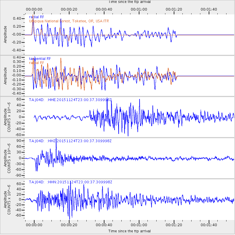
J04D Umpqua National Forest, Toketee, OR, USA - Earthquake Result Viewer
*The percent match for this event was below the threshold and hence no stack was calculated.
| Earthquake location: |
Peru-Brazil Border Region |
| Earthquake latitude/longitude: |
-10.1/-71.1 |
| Earthquake time(UTC): |
2015/11/24 (328) 22:50:53 GMT |
| Earthquake Depth: |
595 km |
| Earthquake Magnitude: |
5.9 MB |
| Earthquake Catalog/Contributor: |
NEIC PDE/NEIC COMCAT |
|
| Network: |
TA USArray Transportable Network (new EarthScope stations) |
| Station: |
J04D Umpqua National Forest, Toketee, OR, USA |
| Lat/Lon: |
43.24 N/122.11 W |
| Elevation: |
1948 m |
|
| Distance: |
70.5 deg |
| Az: |
322.936 deg |
| Baz: |
125.696 deg |
| Ray Param: |
$rayparam |
*The percent match for this event was below the threshold and hence was not used in the summary stack. |
|
| Radial Match: |
75.56599 % |
| Radial Bump: |
400 |
| Transverse Match: |
76.990875 % |
| Transverse Bump: |
400 |
| SOD ConfigId: |
7422571 |
| Insert Time: |
2019-04-21 11:50:38.565 +0000 |
| GWidth: |
2.5 |
| Max Bumps: |
400 |
| Tol: |
0.001 |
|
Signal To Noise
| Channel | StoN | STA | LTA |
| TA:J04D: :HHZ:20151124T23:00:37.309998Z | 10.762138 | 2.5943977E-5 | 2.4106712E-6 |
| TA:J04D: :HHN:20151124T23:00:37.309998Z | 5.2081575 | 1.7782428E-5 | 3.4143413E-6 |
| TA:J04D: :HHE:20151124T23:00:37.309998Z | 2.4306715 | 9.620756E-6 | 3.9580655E-6 |
| Arrivals |
| Ps | |
| PpPs | |
| PsPs/PpSs | |


